|
|
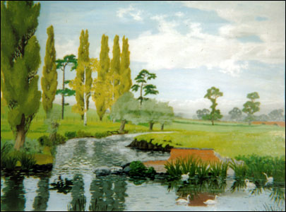
| Painting showing Top Meadow the North Bridges distant right |
Bury field is a vast area of common land situated to the north west of Newport Pagnell. It is common land mentioned as early as 1276. Over the centuries it has been encroached upon several times but still retains its main character. At the centre of the field are two cuttings all that remains of a Victoria railway line that was never completed. Along by the Queens Avenue entrance across to Mill House and adjacent to Union Street are the remnants of a Civil War defensive boundary and over by top meadow an ancient burial mound. At the centre of the common lies a small wooded copse the remains of a walkway known locally as Christmas Walk.
During the 20th Century the field was used for the war effort when some parts were ploughed and used to grow much needed crops. After the war the uses of the field were many fold and used by many of the towns people for recreation. When the field froze over skating would take place and during the summer Thurston’s Funfair would arrive and take centre stage. In the sixties the field was used by the Football and Cricket Clubs. Newport Pagnell Wanderers played their homes matches on the field the pitch now overgrown. The town Carnival was held there attracting many people with events such as scrambling, a parachute drop, and even a Civil War reconstruction battle. The carnival float procession always ended in the field where the judging took place. A famous guest would be on hand for this task and the carnival lasted a week in those days. But, sad to say, the field does not stage any of these events now as locations have been found elsewhere which is such a shame. The field is still used for grazing cows as it was originally intended and people walk and exercise their dogs there. Bury Field holds so much potential and could be used for so much more. Newport Pagnell has grown so much over the last three decades and the common remains but just how many of our newcomers know of its existence and potential. Who knows what its future holds at the mercy of the 21st century.
The picture from a water colour shows the top meadow by the River Ouse in the distance to the right can be seen the north bridges.
Don Hurst
|