
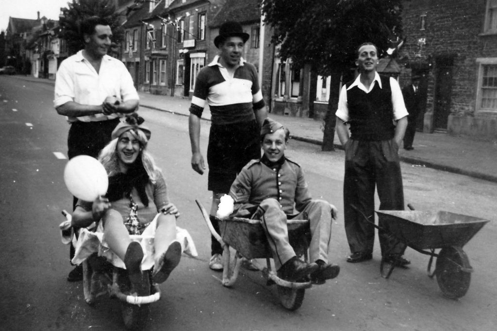
Why not give the trail a ‘live’ test in the High Street itself? If you do, ensure you have a pair of earphones about your person for your phone to deal with any occasional excessive traffic noise!
Click a heading to reveal the text, and then click the audio bar for the voiceover. Clicking a header again will hide the text.
.
.
.
.
.
This trail presents a ‘light’ introduction to the history of Olney High Street and several of its interesting buildings.
If you choose to walk this trail, it should take around 45 to 60 minutes.
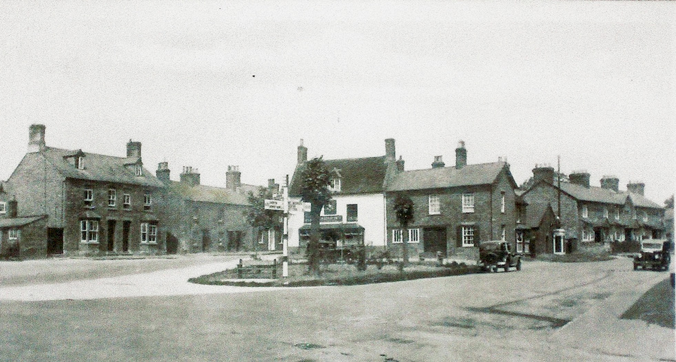
The wide High Street stretching from the Market Place in the south to the Knoll at its north end is arguably the major feature that makes Olney so attractive and a very desirable place to live. The width is complemented by the various styles of attractive houses intermingled with small stone cottages and traditional business premises.

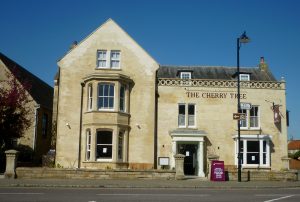
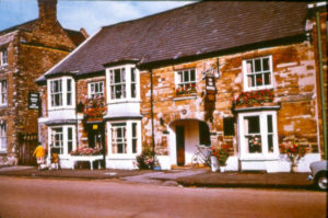
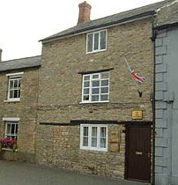
The Cherry Tree Restaurant
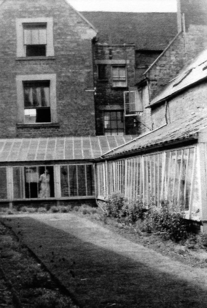
The trail begins at the Market Place on the pavement outside the Cherry Tree Restaurant which provides a good perspective of the wide High Street.
.
.
.
.
.
There appears to be no ‘serious’ research undertaken that fully explains the development of Olney’s wide High Street. A reasonable understanding, hopefully as summarised in this trail, has been gained from books written in the recent past by local authors. A selection of these books is available in the Public Library situated in the Olney Centre in the High Street.
In centuries past, the High Street comprised three elements, the most significant being the stream which flowed down the west side of the High Street with dilapidated banks propped up with wicker work with overhanging willow trees. The stream emerged from Spout Lane (now Spring Lane) and ran in a northerly direction along the High Street until it met another flowing in the opposite direction from Yardley Road at the northern end of the town. They met at a point called the High Arch (believed to be sited somewhere between Millward’s Entry and the Two Brewers Inn), broadly half way along the street, where they joined and flowed eastwards down across the meadow to the river.
(During the great fire of Olney in 1786 it is said that many dwellings escaped being completely burnt out because of the proximity of the stream in the High Street.)
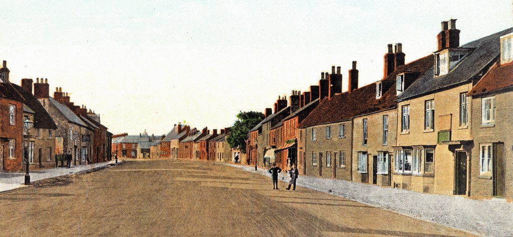
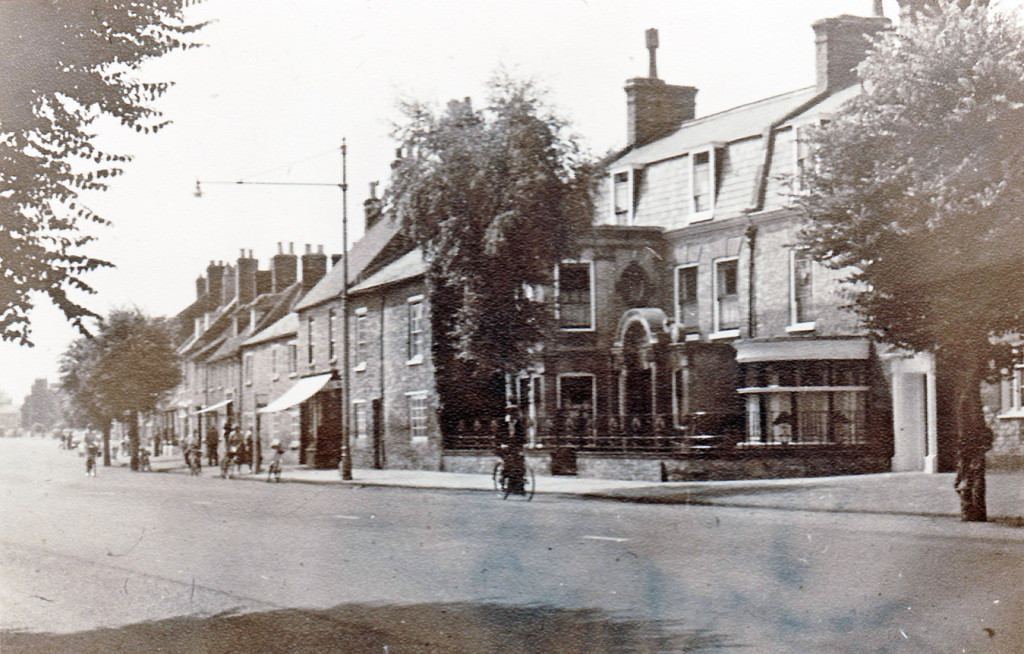
The High Street (Southern End) c.1900
The second element was the raised wide pitched causeway that ran down the centre of the High Street, where pedestrians could walk dry-shod when the stream was in flood. The causeway extended from where No. 6 High Street now stands to the Queen Hotel (a distance a little over one kilometre). It was kept in repair by the Causeway Charity. The causeway was removed in 1790.
The third element was the track for wheeled traffic sited on the east side of the High Street.
Together these three elements resulted in the wide high street as seen today.
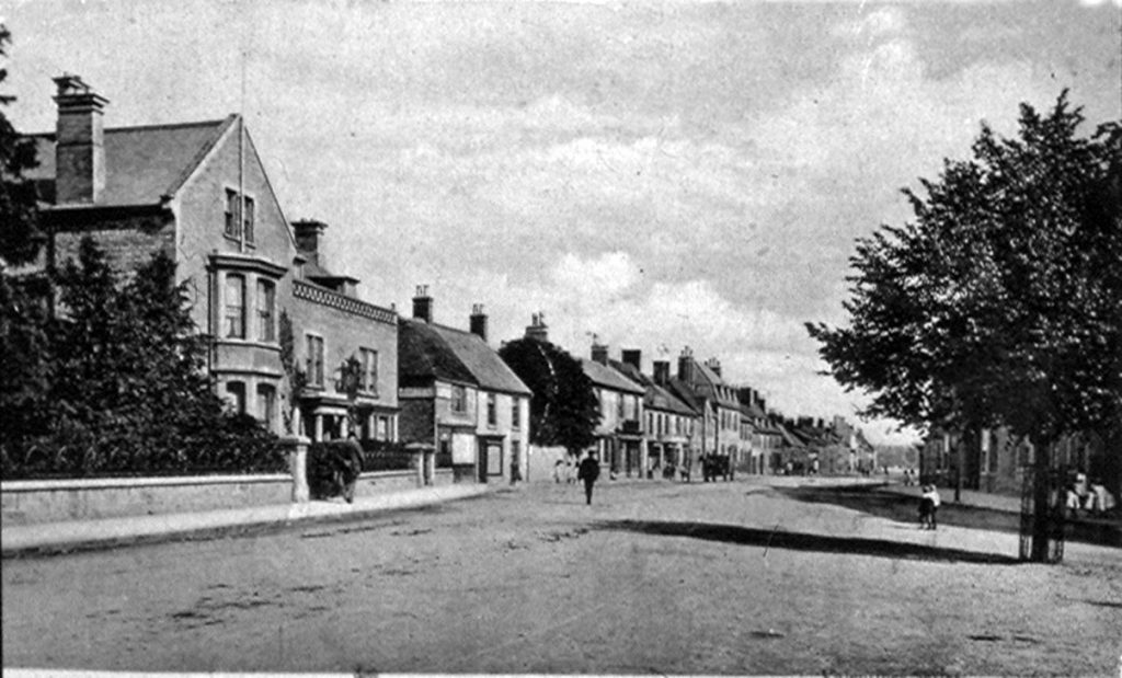
The High Street (Upper Central) c.1900
The High Street was lined with stone-built and thatched cottages, with here and there a well built house. It was not until the 16th Century that houses were built in Olney facing the street. Previously the front doors were in Courts or Alleys, as in the 20th Century we recall Berrills, Fields, Floods, Swains, Cobbs, Morgans and Yorks Courts.
Olney was fortunate in that houses could be built from materials found locally; with limestone quarries near to hand, the forests on their doorsteps for oak for the beams and ash for the laths, with straw (reeds) available too for when they began to thatch.
Incidentally, the High Arch was the end of the town’s traditional whipping run which started at the Town Pump (sited close to Costa’s café) on the Market Place. This drastic punishment at the cart tail was administered by the Town Beadle and probably quite effective. No doubt it was enjoyed by the watching townsfolk and an awful warning to youngsters witnessing the scene!
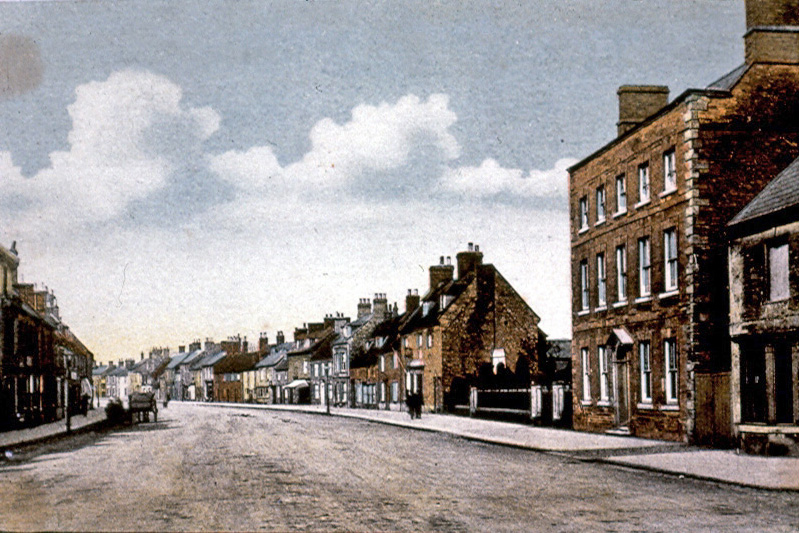
The High Street (Lower Central) c.1900
The street must have looked very picturesque with the stream running down it, but one wonders just how salubrious it was, as there was no waste collection in those days and the temptation must have been quite strong to use the stream as a dumping ground. Incidentally, Mr Garrard, a solicitor, was the last person to hold the duck shooting rights for the High Street.
Now fast forward to the present; when you have an opportunity let your eyes run along the roof-line all the way along the High Street (on either side). The fact that no two houses are at precisely the same height is most noticeable and this certainly adds to the considerable charm of the town. Also, no major houses are exactly alike, and what could be described as almost a mansion stands ‘cheek by jowl’ with a small cottage.
The next Point of Interest in this trail is the Two Brewers Inn, situated some 300 metres from the Cherry Tree restaurant along the east side of the High Street.
.
.
The next Point of Interest in this trail is the Two Brewers Inn, situated some 300 metres from the Cherry Tree restaurant along the east side of the High Street.
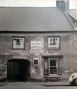
The Two Brewers Inn appears to have spent most of its time as two separate properties. A closer look at the ground floor reveals an archway between the two front entrances to the building; the centre of the arch housing the bar area. Until the building was redeveloped in the early 1950s the larger building on the north side housed the Mechanics Institute and the Conservative Club and the smaller building on the south side the Two Brewers Inn (formerly The Queen’s Head).

The Two Brewers Pub (mid 1950s)
In earlier times the archway between them was the primary route for the fire engine to reach the High Street from the Olney Fire Station situated towards the rear of property adjacent to East Street. After the siren had sounded, summoning the firemen to the station, it must have been exciting to watch the fire engine, with its bell frantically ringing, emerge from the narrow archway into the High Street.
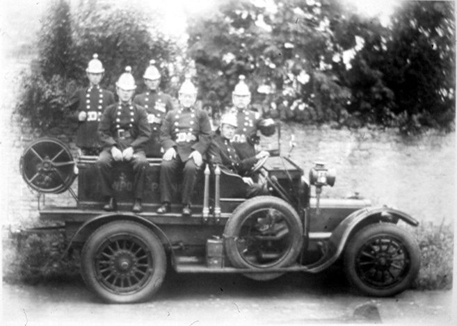
Olney Fire Brigade (Early 1930s)
The photographs of the former Two Brewers were believed to have been taken in the late 1940s or perhaps the early 1950s. The first clearly shows the size of the archway leading from the High Street to the Two Brewers yard, which led directly to the fire station beyond at the bottom of the yard.
The Two Brewers Inn
during the late 1940s
The second photograph, again taken from the High Street, shows a closer view of the archway and particularly the sheet metal tracks used to align a vehicle’s wheels when passing through the archway so as to avoid damage to the walls of the archway.

Close view of the archway
looking from the High Street
The ODHS is indebted to a granddaughter of Bob Ford, former manager of the Two Brewers Inn, for providing these photographs for inclusion on this website.
During WW2 on the night of 28th October 1940, a German bomber dropped a fairly large bomb in the meadow on the Clifton Reynes side of the river Ouse adjacent to the railway line. It was, supposedly, intended for the railway bridge which it missed by a couple of hundred metres or so. However, the resulting blast was so severe that, having progressed towards Olney and up the yard of the Two Brewers Inn, it funnelled through the archway and completely blew out the two large shop windows of the shop on the other side of the High Street, then called ‘Linco stores’ and now ‘Stephen Oakley Estate Agents’. This bombing incident is recorded in Mr J J Garners WW2 Diaries, reproduced on this website, and confirmed by Bucks County Council’s ‘Bombs over Bucks’ website which reports that 69 properties were damaged that night in Olney and Clifton Reynes..
The ‘Linco’ Stores photo showing the shop windows that were blown out by the WW2 bomb
In the 1950s the Two Brewers developed into a very popular and successful pub under the management of Bob and Ida Ford, possibly because it catered for a broad age range. When they retired in the 1970s, Jack Druce acquired the tenancy and again the pub prospered and arguably continued to be the most popular pub in town under his management. Indeed, the business remains successful to the present day..
QE11 Coronation Festivities 1953
outside the Two Brewers
.
Incidentally, it is reported and ‘broadly accepted’ that the last appearance of the Devil in Olney was at the Two Brewers Inn!
.
.The next image is a manually assembled composite view of four adjacent buildings photographed in the late 1940s. That is: from left to right, the Working Mens Club (now the Carlton House Club), Clifton House, the Olney Mechanics Institute and the Two Brewers Inn. Clifton House, the next Point of Interest on this trail, was demolished in the late 1950s.
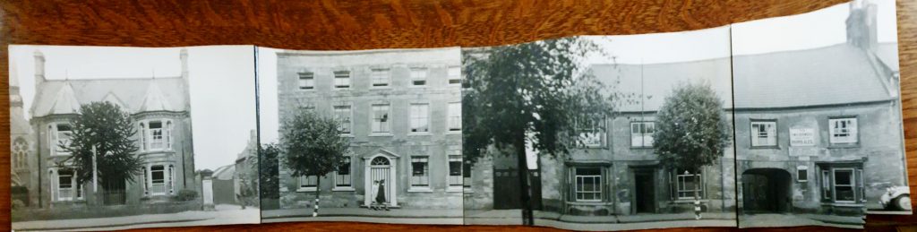
Composite image of four adjacent High Street properties in the late 1940s
.
.
.
Should you have looked to the left of the Two Brewers Inn in the 1950s, rather than looking at a wooden fence as you do today, you would have been confronted by Clifton House, a large Georgian style building standing between the Two Brewers Inn and the Carlton House Club.

Clifton House c.1950s
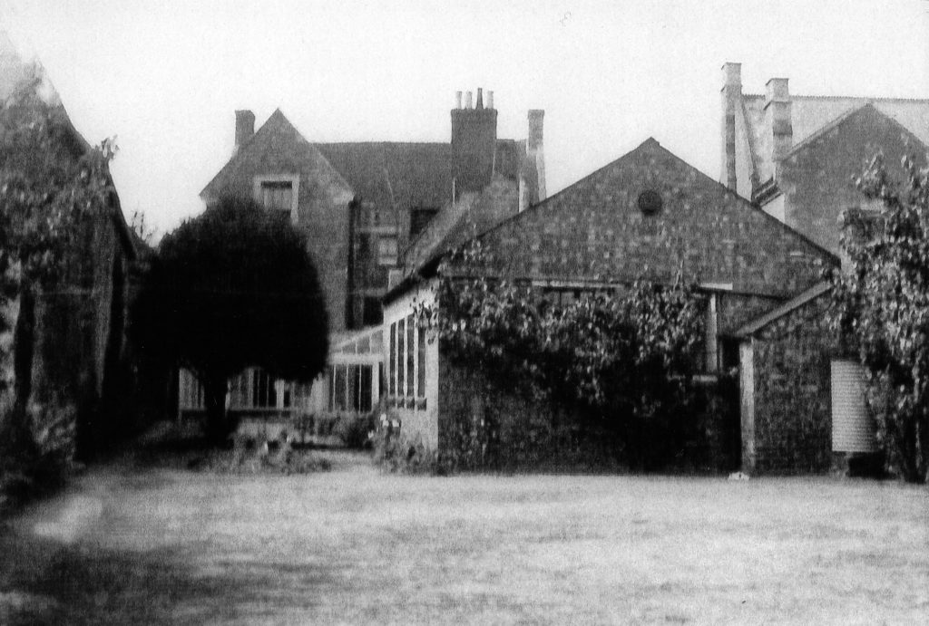
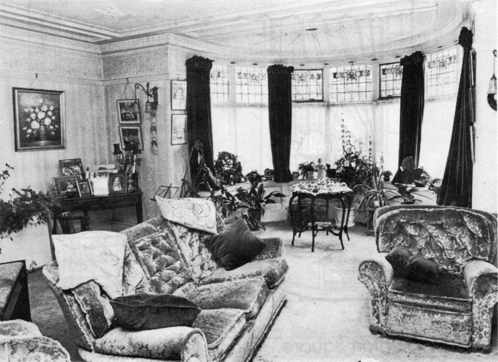
Clifton House, the next Point of Interest, was a very imposing property on the High Street. Early details of the building, its purpose and its occupants are difficult to ascertain. In 1891 John Hamp, an Estate Bailiff, and his wife Elizabeth lived in the house, whereas in 1910 the house was owned by Annie Cooper who resided there.
By 1936 Horace Cowley, a shoe-factory owner, had moved into the house with his family. The family still had a presence there in 1951. The ODHS is indebted to descendants of the Cowley family for providing the following group of photographs of the building, which includes a view of the billiard room at the rear of the house.
The lounge of Clifton House c. 1950s
.
Billiard Room and Yew Tree c. late 1940s
.
Clifton House c. late 1940s (1)
.
Rear of house c. late 1940s
.
Clifton House c. late 1940s (2)
.
The property was converted into flats in the 1950s, some of which were leased to American Servicemen stationed at the ‘Chicksands’ base near Bedford.
Later that decade the building developed substantial structural faults, with major cracks clearly visible on the southern face of the property.
Sadly the building was demolished during the mid to late 1960s. The plot now belongs to the Carlton House Club, next door to the left, and performs a useful role as their beer garden. Maybe a different decision would have been taken today, which might have resulted in the building being repaired and restored.
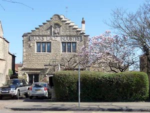
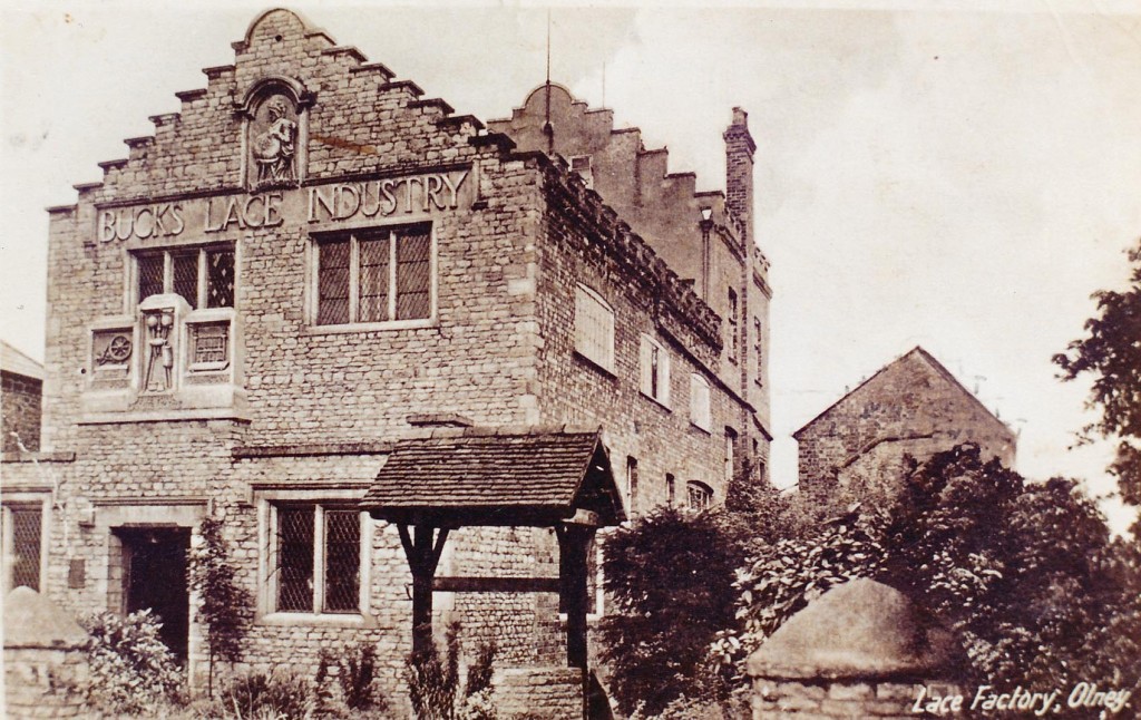
Some 60 metres metres further along the street will bring you to the former Lace Factory, the next Point of Interest.
.
.
.
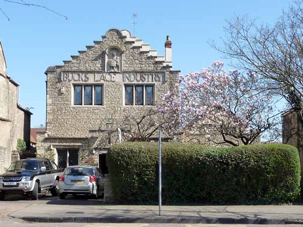
The ‘Lace Factory’ – a recent photograph
Some 60 metres metres further along the street will bring you to the former Lace Factory, the next Point of Interest.
The building of the Lace Factory is the last example of a commercial attempt locally to keep the lace industry viable, in spite of the changing economic climate and the vagaries of fashion. The earlier buildings on this site were destroyed by fire in 1924.
The factory was built in 1928 by a slightly eccentric character, one Harry Armstrong, who hailed from Stoke Goldington. He employed George Knight to build him ‘something the like of which Olney had not seen before’. Builder George had to talk him out of Corinthian columns and other fanciful designs.
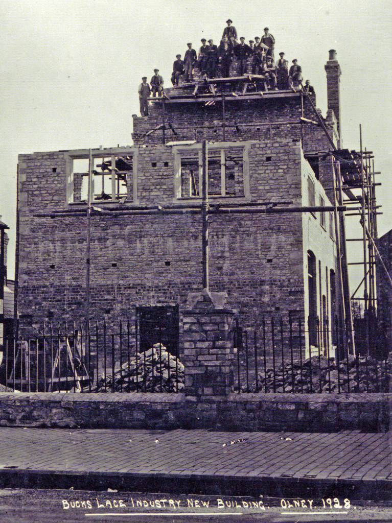
The ‘topping out’ ceremony of the Lace Factory
The photograph shows the ‘topping out’ ceremony on the top of the factory building; which doubtless would not meet today’s Health and Safety Requirements!
Being the time of the Great Depression, the building was constructed mostly with second hand materials. The only work with new materials was the façade over the front door, which included three huge carvings of a bobbin winder, candle-stool and a bobbin stand.
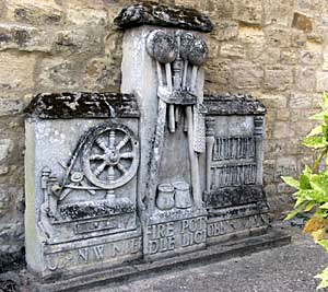
The façade which now resides at the Cowper & Newton Museum
The next photograph is of the finished building, adorned with the heavy façade, which was later removed for safety reasons.
The completed Lace Factory (1928)
Lace was never made in the Lace Factory. It was used as offices and a warehouse, where lace was sewn onto garments or any article that Harry thought could be adorned with lace! It was then packed into parcels which were sent out worldwide.
The lace was made by women in their homes and brought into the Lace Factory for sale, or was collected by agents in local villages. The lace makers had to buy the thread for the next week’s work out of their earnings.
The lace maker in the photograph is of Mrs Mary Wooding, taken around 1930. She could be categorised as a typical Olney lace maker and lived in Osborn Court. As this court was accessed via an entry adjacent to Number 51 High Street, opposite the Lace Factory, she may well have sold her lace to Harry Armstrong.
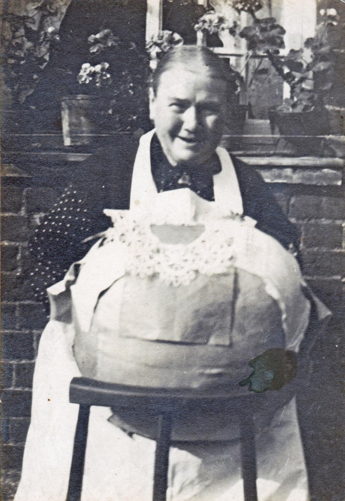
Mrs Mary Wooding c.1930
Harry advertised his business in women’s magazines, and by sending out postcards touting for business from individual women or women’s groups. A response would result in the dispatch of a parcel of lace ‘on approval’. Prospective purchasers were given a month to pay up or return the goods. The late Cis Elderton who worked in the office for him said they lost very few parcels. “People were honest in those days” she said.
The photograph of the girls employed at the factory was taken in July 1931, and includes the late Cis Elderton (the fifth lady from the left).
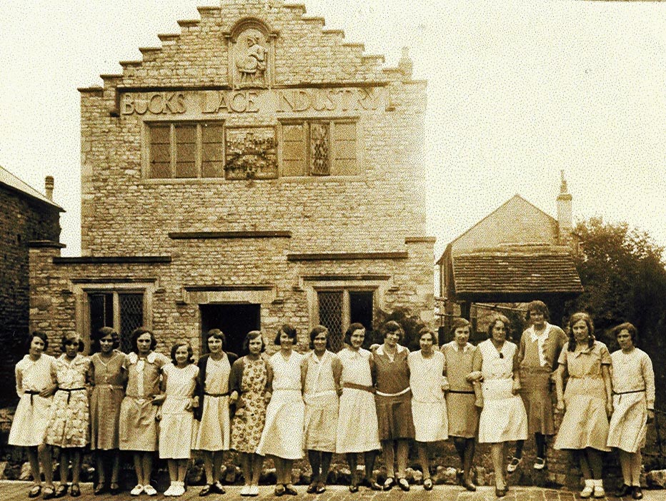
Girls employed at the Lace Factory
– July 1931
Harry was quite a character as he traded as ‘Mrs Armstrong’, believing women were more likely to buy lace from another woman! Sadly, he died at the early age of 56 while on a business trip to Scotland in 1943.
Thereafter lace making in Olney, as a business, was carried on only by a few older women who made lace for gifts.
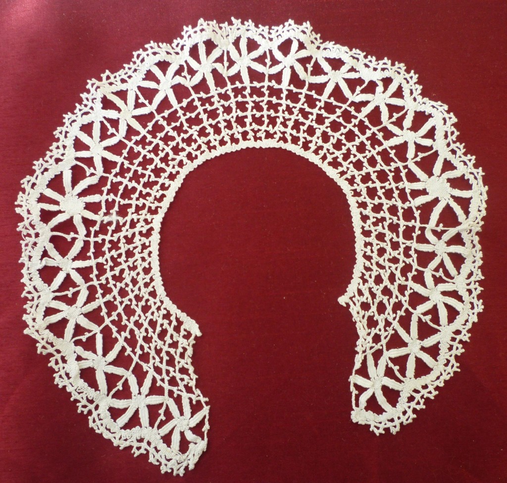
A photograph of a lace collar is included to illustrate a typical example of lace that could have been processed in the ‘Lace Factory’.
Lace making enjoyed a revival in Olney in the 1970s. But by this time, the once traditional cottage industry had become a leisure time craft.
.
Some 200 metres further along the street is a Zebra Crossing where the next Point of Interest ‘Lord’s Malting’ is situated.
.
.
.

The Maltings – a recent photo
Some 200 metres further along the street is a Zebra Crossing where the next Point of Interest ‘Lord’s Malting’ is situated.
John Lord acquired these maltings in the High Street around 1840. John is generally acknowledged to have developed the first extensive brewing business in Olney. John Lord was presumed to be born in Weston Underwood, date of birth unknown. Records can support that some ‘Lords’ lived in Weston Underwood in the mid eighteenth century. In William Cowper’s time, Samuel Teedon, a friend of the poet and a teacher in Olney, wrote in his diary ‘whilst at Weston, Mrs. Lord brought Cowper some roast beef down from the farm’.
John, his family and close relatives owned some seven public houses, The Boot, The Bell, The Sun, The Duke William, The Cock, The Dolphin and (at the south end of the town) The Red Lion. This malting at 104 high Street was the only one (of five) not attached to a public house. It is possible that the Lord family transferred its malting business to the premises in the High Street after they left the Boot Inn around 1840. An old beam in this malting has the date 1 August 1835 carved into it, with the two carpenters’ names.
.
The former Boot Inn – Bridge Street
.
The former Duke William Inn – High Street
.
The former Sun Inn – Weston Road
.John Lord appears to have been an ambitious brewster. Unfortunately, following his death in 1812, his brewery operations appeared to become fragmented amongst his family. Had the business continued under John, it is possible that it would have expanded further, and as a consequence, it probably would not have been viable for Hipwells to develop their brewery interests in Olney at that time. However, his apparent early death paved the way for them eventually to buy all seven public houses in the 1860s and 70s, and judging by the grand dwellings that the Hipwell’s later built in Olney, there was still a fortune to be made in brewing.
.
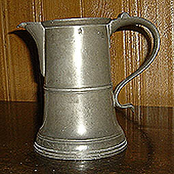
A pewter quart-sized measuring jug owned by John Lord. The inscription under the spout reads ‘J Lord Boot Oulney Bucks 1805’
The three storey malting is Grade II listed as early nineteenth century maltings. The building has been used for several purposes since it ceased being used as a malting, including the manufacture and storage of lampshades. It now used by a business designing bespoke packaging.
.
The Knoll, the next Point of Interest, is reached by crossing the road using the Zebra Crossing. Then walk some 200 metres in a northerly direction on the west side of the High Street to Number 133 High Street (Town Farm). This position provides an excellent vantage point for the Knoll.
.
.
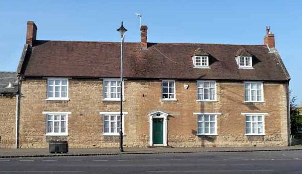
133 High Street (Town Farm)
.
The pavement outside Number 133 High Street provides an excellent vantage point for the Knoll, the next Point of Interest.
Past local historians have suggested that in the northerly direction a few hundred metres beyond the Knoll, a castle, or a monastery, once stood on the east side of Yardley Road.
In addition, with a little more certainty, before the parish church was re-built in its current position in the 14th Century, a church once stood not too far behind the Knoll. Evidence in the form of human remains were found when digging out the footings for the Feoffee Cottages in Dartmouth Road. Also, until the 1950s there was an elm tree, known as the ‘Churchyard Elm’ located opposite the Queen Hotel. These suggest that this northern end was perhaps at one time the most important part of town.
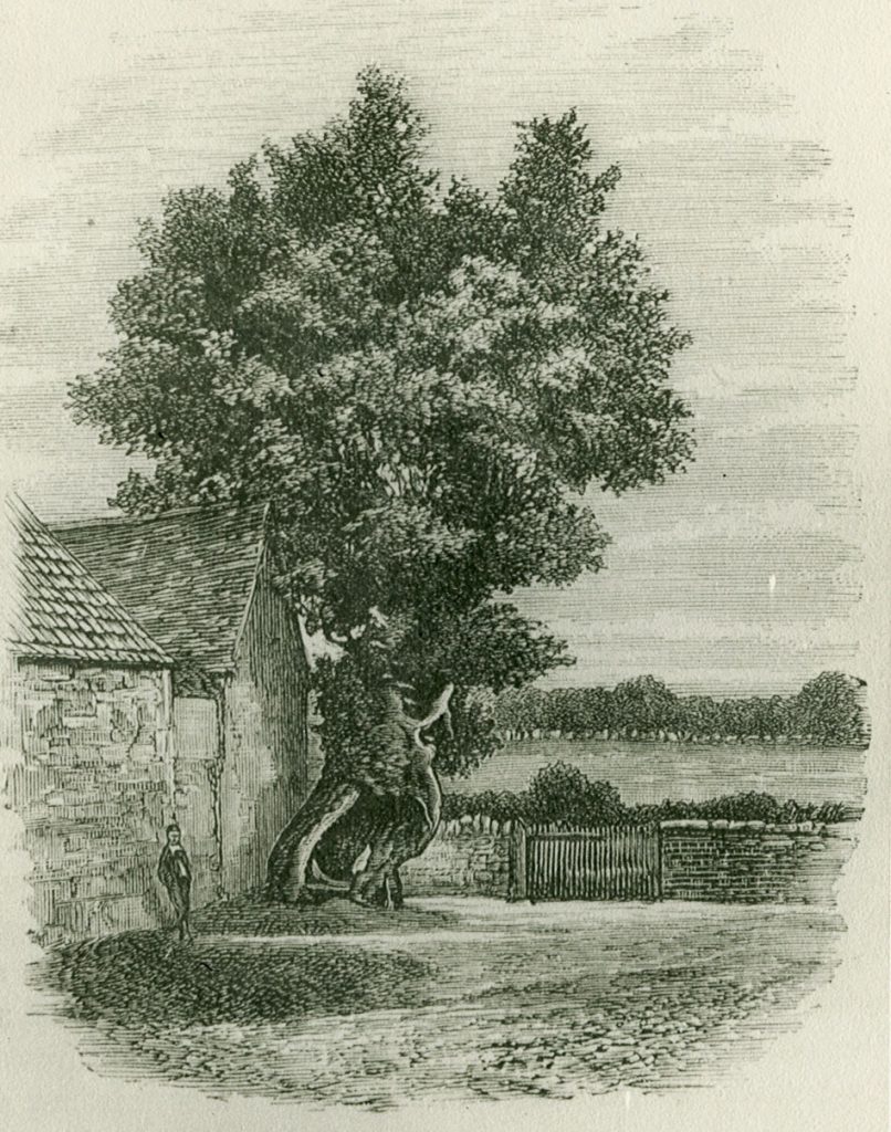
The Churchyard Elm
There are no records to indicate why the church moved to its current location, although many theories abound!
Moving along the time-line somewhat, say to a couple of centuries ago, the northern end of Olney, with the exception of a handful of properties, ended at the Knoll.
Beyond the Knoll today is the development that emerged after the coming of the railway through Olney in 1872. The building of the new streets was intended to accommodate the number of workers that would use the railway to work outside the town, probably in Northampton or Bedford.
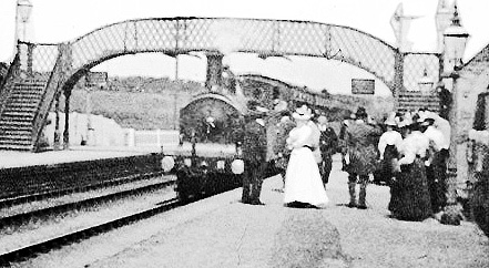
Olney Railway Station in 1911
In reality most, particularly office workers, used buses as the frequency of the trains was insufficient for their needs. As it happened most properties were let, initially at least, to shoe industry workers as the majority had workshops, even mini factories, built at their rear. These were used by the tenants, working as outworkers, to service the larger shoe factories in the town.
In the 20th Century, on the north side of the Knoll, stood two buildings. The building on the left was the Castle Inn, a very popular inn after World War Two when managed by ‘Auntie’ and ‘Uncle’ Fred Lyon. It was the only pub in town that was not owned by brewers Hipwells (and later Phipps, a Wellingborough brewery). The Castle was owned by the Northampton Brewery Company.
The Knoll c.1910
The building on the right was a blacksmith’s workshop which continued shoeing horses well into the 1950s. The last blacksmith was Alistair Bull who lived ‘over the shop’.
The Castle Inn was substantially extended into its current form after the demise and demolition of the smithy. This much enlarged pub ran very successfully for a number of years. The premises have relatively recently been fitted out as the ‘Maya’ Indian restaurant.
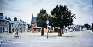
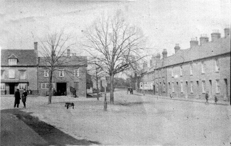
The Knoll c.1900
On the 1900 image observe the lighter coloured track that crosses the road, just in front of the cyclist and lamp post. There were two such tracks across the High Street, one at each end, which were ‘apparently’ kept clean so that the ladies did not soil the hems of their clothing with mud, or even worse!
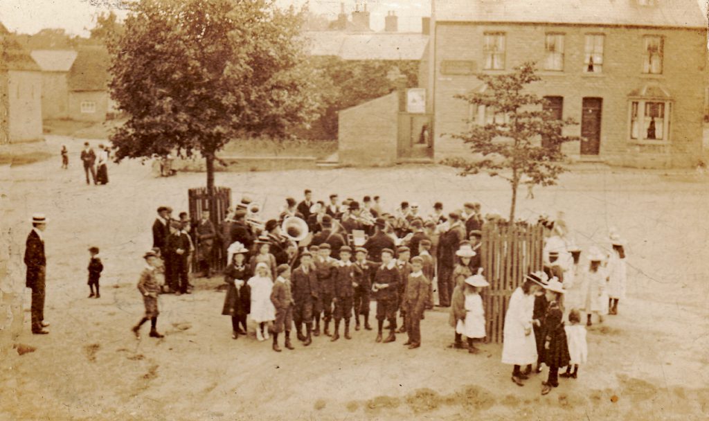
Olney Silver Band on the Knoll -1899
The photograph of Olney Silver Band was taken by George Lett in 1899. The band was preparing to play on the Knoll, probably on a Sunday, as everyone was turned out in their ‘Sunday best’ clothes.
The Knoll was not surfaced at that time (incidentally neither was the Market Place) and it is common knowledge that the surface was far from flat owing to children scraping holes in it on a regular basis to play marbles!
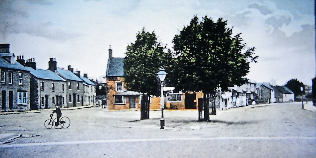
The Knoll c.1948
The 1948 image shows no significant structural or environmental changes over the 50 years since 1899. Except that the Knoll itself has been converted into a small garden.
But who would have thought that after another 50 years, the A509 road, now nominated a ‘UK trunk route’, would completely shatter the peaceful nature of this part of town, with numerous very heavy vehicles travelling to Milton Keynes and the M1 Motorway,
Continue the trail by walking 200 metres back towards the Market place on the west side of the High Street until you arrive at Cobbs Gardens, the next Point of Interest.
.
.
.
The next Point of Interest is Cobbs Gardens on the west side of the High Street, reached by walking 200 metres from the Knoll back towards the Market place.
Cobbs Gardens is the name given to one of the best known ‘courts’ of tenement buildings in the town. In the first half of the twentieth century it comprised some ten or more small cottages, each cottage often housing large families.

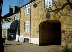
The archway leading to Cobbs Gardens
– a recent photograph
The cottages were accessed through the archway. The ‘gardens’ were situated outside the tenant’s front doors.
The second photograph was taken around the 1920s from inside Cobbs Gardens, looking east towards the archway in the High Street.
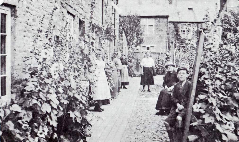
A photograph taken from inside Cobbs Gardens (c. 1920s)
looking east towards the archway in the High Street
The cottages were demolished in the 1960s and have since been replaced by the NHS Cobbs Gardens Surgery.
To the left of the archway is Sandwich Land, which sells a broad range of sandwiches, pastries and coffee. In a former life it formed part of a bakehouse complex belonging to Freddie Richardson and later Alf Harrison. The bakehouse at its rear could be accessed by walking through the archway and then immediately turning left.
On Sunday mornings in the 1930s and 1940s, when Freddie Richardson owned the bakery, housewives (who had neither gas nor electric cookers with which to cook their Sunday roasts and Yorkshire puddings) walked their assembled roasting tins covered with tea towels through the archway to the bakery oven. This bakehouse took in some 50 to 70 roasting tins every Sunday morning which were collected from 12 noon onwards for a charge of about 1p.
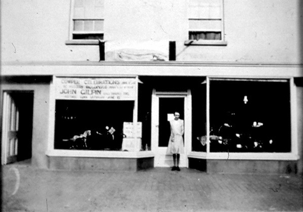
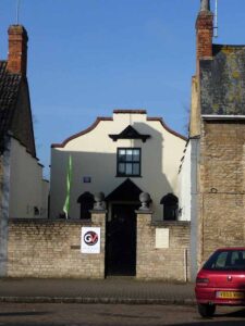
Continue the trail by walking some 70 metres towards the Market Place to Number 79 High street, the light coloured building set back a little from the pavement. This property, the next Point of Interest, was originally built as a hall called the ‘New Hall’ but was later converted into a cinema called the ‘Electric Cinema Olney’.
.
.
.
The next Point of Interest is Number 79 High Street, a light coloured building set back a little from the pavement. It is reached by walking some 70 metres towards the Market Place. This property, the next Point of Interest, was originally built as a hall called the ‘New Hall’ but was later converted into a cinema called the ‘Electric Cinema Olney’.
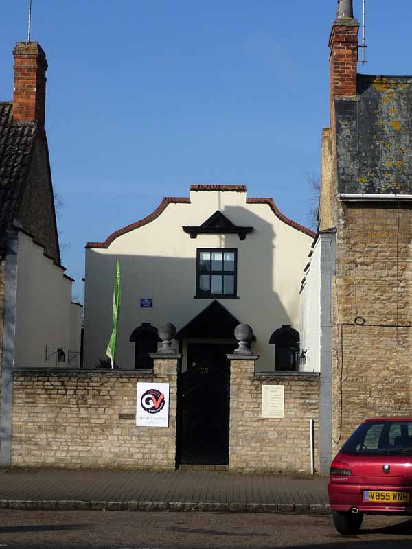
A recent image of 79 High Street
The following is an edited extract from a letter written in the early 1990’s by the late Percy Wright of Olney. Percy seems to summarise perfectly what the locals remember of the happenings in this building.
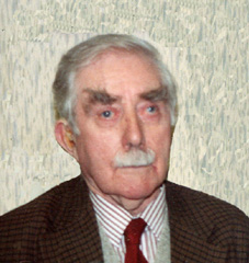
Percy Wright in his later years
‘Mr Lewis Thompson, was an Olney grocer trading at 9 High Street in the early twentieth century. He had a hall built to be used for concerts, meetings and dancing; and having a stage the hall became very popular. Often at Election Meetings it could get a little rowdy with opposing supporters almost coming to blows. The building was called the ‘New Hall’ and it was used by the townspeople for many years.’
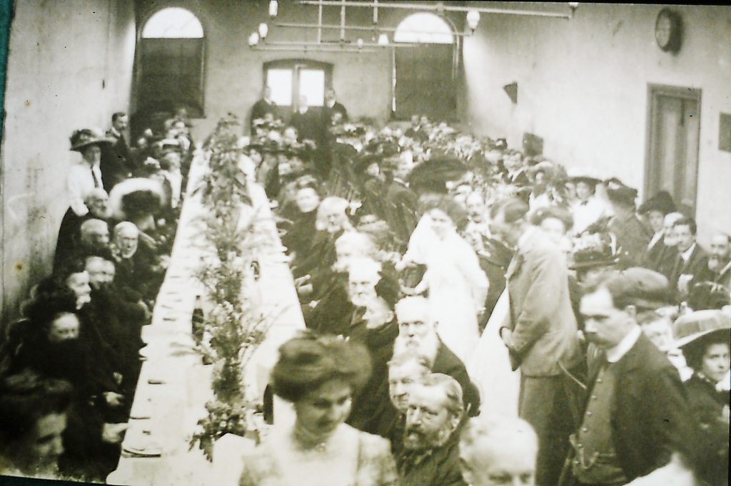
A Senior Citizens Dinner in the New Hall
.
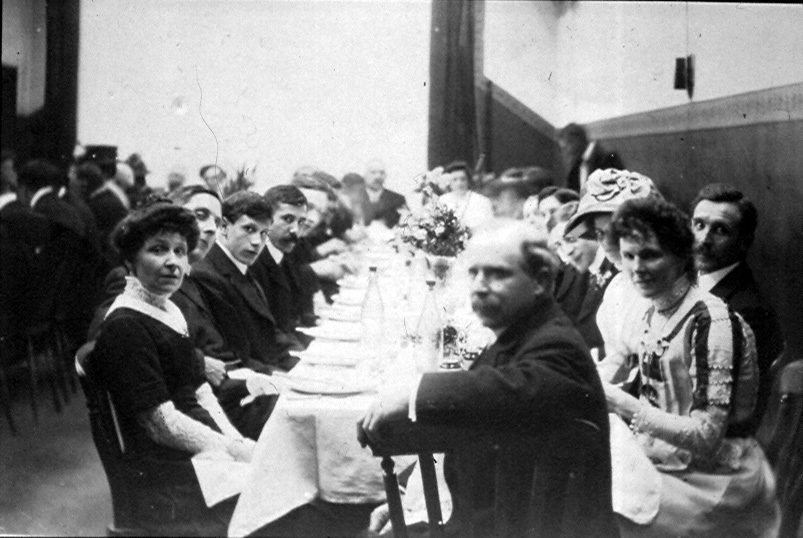
Sowman’s Staff Dinner in the New Hall
The two images are of typical functions that were held in the hall. Unfortunately the dates of the photographs of the Senior Citizen’s Dinner and the Sowman’s Company Dinner are unknown .
‘Some years later, in 1919, the hall was bought by Mr Clifford, who converted the front of the building to form a cinema. The front of the building stood a few metres back from the pavement with two steps leading up to the two front doors. Inside was a vestibule with a ticket office on the right hand side. The projection room was built over the front porch, with an outside staircase leading up to it. The first proprietor was Mr Clifford. His wife was known as ‘Madam’ Clifford.‘
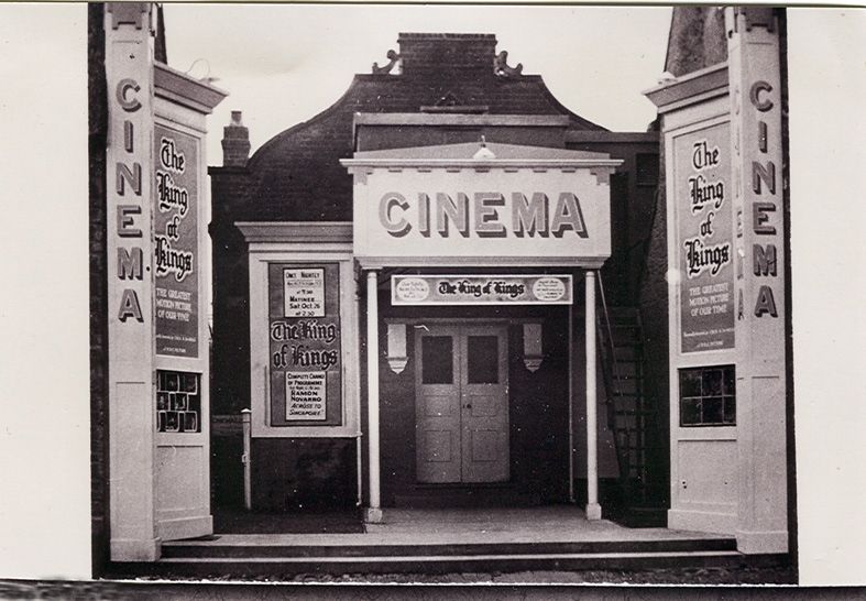
The film being shown was the 1927 ‘King of Kings’
a silent film directed by Cecil B de Mille an iconic film of its day
The next image show the front of the cinema. The film being shown at the time was the 1927 ‘King of Kings’, a silent film directed by Cecil B de Mille – an iconic film of its day.
‘The seats installed near the screen were more like forms. Behind them came the wooden single tip-up seats and then a few rows with padded seats. The seats at the rear, just inside the left hand side of the hall, were plush padded with arm rests, and the floor for these had been made a little higher so that people could look over the heads of those in front.
In the early days, since there was no sound to accompany the film, when a performance was ready to begin, ‘Madam’ Clifford walked, much like a Duchess, down to the piano. When she was sitting comfortably on the piano stool, the cinema was plunged into darkness and the projectionist, Mr Chapman, started the performance by turning a handle to feed the film through the projector. As the story unfolded ‘Madam’ Clifford would play very softly and slowly for a sad scene, and fast and loud for galloping horses or cowboys and indians fighting.’
The next image is a well-published postcard of young customers taken outside the cinema around 1920.
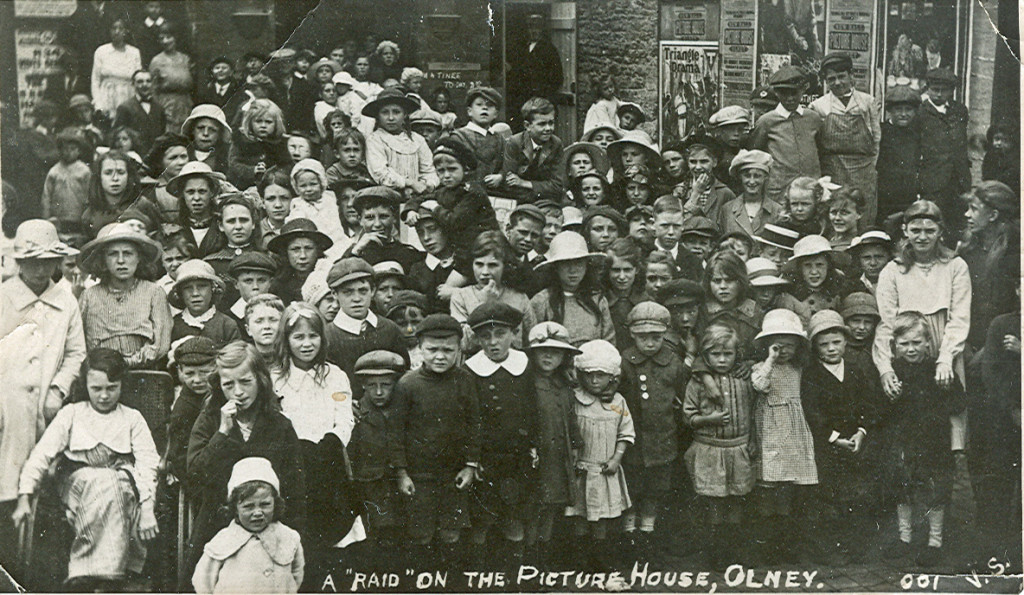
The well-published postcard/photograph taken outside the cinema around 1920
.
In the cinema’s later years when silent films were long gone, Mr Webster became the proprietor and Alistair Bull the projectionist. The cinema closed in the early 1950s.
Continue to the Nos 67 & 69 High Street – Orchard House, the next Point of Interest, by walking a further 100 metres towards the Market Place.
.
.
.
The next Point of Interest, Nos 67 & 69 High Street – Orchard House is reached by walking a further 100 metres from 79 High Street towards the Market Place.

Recent photograph of Orchard House
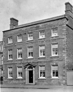
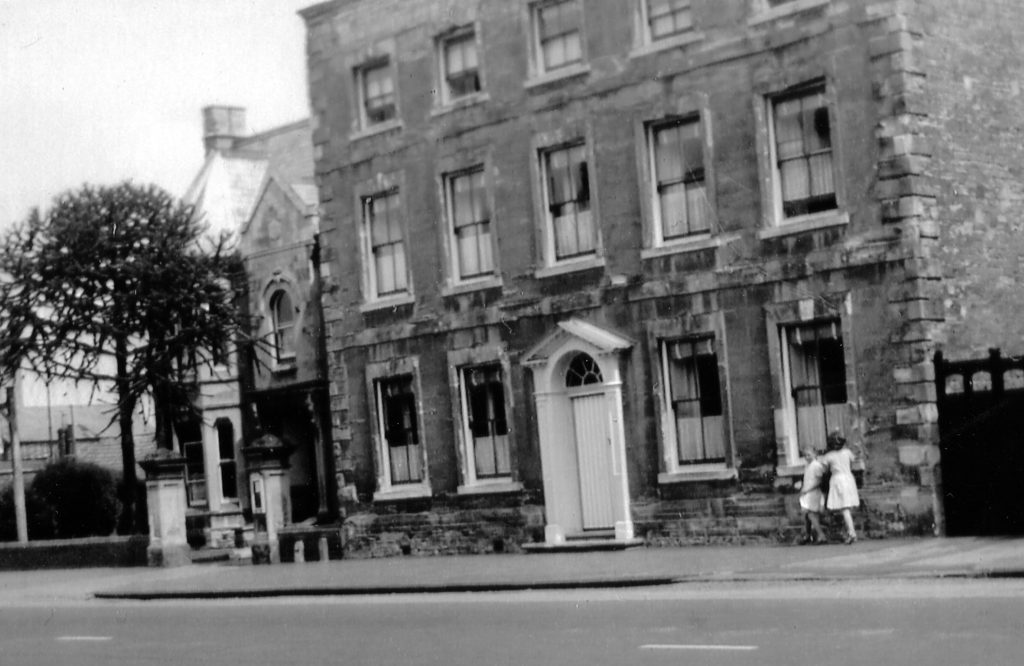
Orchard House was converted from two eighteenth century houses in 1904 for Joseph William Mann; the architect was Alexander Ellis Anderson. J W Mann was at that time Olney’s largest employer, having moved to Olney from Northamptonshire in 1880, and founding a shoe factory here in 1884 with his partner, William Hinde.
J W Mann was not only of some standing in the town as a local manufacturer and employer, but also seems to have been a generous local benefactor, as well as being involved in bringing social and economic improvements to the town in the early twentieth century.
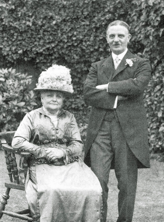
Joseph Mann & his wife Harriet
It is not clear when J W Mann purchased Nos. 67 and 69 High Street. Early Ordnance Survey maps show that they were two properties in 1882 but were already one by 1900, although very different in plan to the present. It is recorded that Orchard House was the first house in Olney to have electricity, which was powered by a generator housed in a small brick building in the garden.
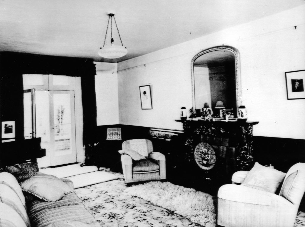
The Drawing Room
An interesting external feature is the cast iron railings above a stone wall to the front of the house; the tree design incorporated into the railings introduces the orchard theme. The railings were lucky to survive the Second World War, as other houses with railings in the town (there were many such properties) had their railings requisitioned and removed to support the war effort – as happened all over the country. The railings at Orchard House were listed and therefore thankfully exempt from this, subsequently highly controversial, regulation.
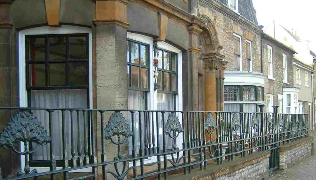
Orchard House – Railings detail (2012)
Orchard House had a large billiards room which was useful for both social and business purposes. J W Mann would combine both and on one occasion around 1904 when there was a battalion of Lancers stationed at Weston Underwood for exercises, he invited the Colonel-in-charge for a game of billiards with C M Allen , another local business man. They had a convivial evening accompanied by a few whiskys and cigars, by the end of which he had secured an order for boots for the whole battalion!
Orchard House c.1950
J W Mann was not only an astute business man but also a meticulous dresser. He was a familiar sight walking in the middle of the High Street from Orchard house to his factory at the top of Midland Road dressed in his bowler hat, silver topped cane and grey spats over his Hinde and Mann shoes.
The next and final Point of Interest is Number 9 High Street, situated a further 200 metres towards the Market Place.
.

.
.
The final Point of Interest, Number 9 High Street is reached by walking a further 200 metres from 67 & 69 High Street towards the Market Place.
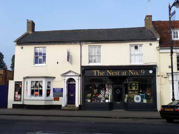
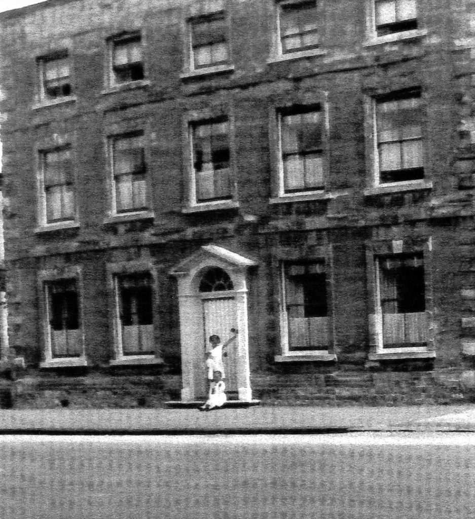
No 9 High Street (2013)
Number 9 High Street is listed as an eighteenth century building and has probably spent most of its life as a successful grocery store. The 1891 Census records Thomas T Coles a grocer and wine merchant, living at Number 9 with his wife and family. As both Thomas’s father, Benjamin Coles, and grandfather, Daniel Coles were Olney grocers, it is conceivable that Number 9 had been in the family for some years.
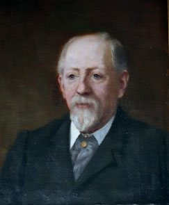
Portrait of Thomas T Coles
The 1910 Revenue Survey indicates that, although Thomas T Coles still owned the property, he had moved into Springfield House, a rather large property in Yardley Road. This building is now known as Broomfield and is a residential home.
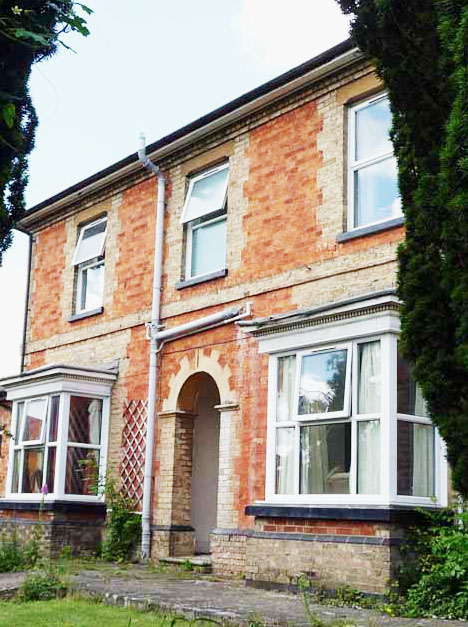
Springfield House now Broomfield
Lewis Thompson ran the business at this time (in 1910) as a Provision Merchant. The 1910 Survey also shows that Lewis Thompson owned some 22 houses and cottages in the town. This was the same, previously mentioned Mr Thompson, who had the ‘New Hall’ built for concerts, meetings and dancing; later to become Olney’s cinema. Mr Thompson retired to ‘Ivy Cottage’ a large house in Midland Road.
The shop was later managed by national grocers ‘International Stores’ for some years until the rapid growth of supermarkets in the 1960s. This store, together with the Co-op store across the road (Numbers 16 and 18 High Street), were arguably the two most successful grocers in the town during the 1940s and 50s.
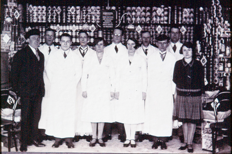
Staff working at the ‘Inters’ as it was known locally
In the 1980s the shop was leased to building societies, including the Woolwich Bank, for some 25 years or so, whilst the remainder of the building was given over to offices and healthcare facilities. The frontage of the building has remained essentially unchanged since Thomas T Coles owned it more than a century ago.
.
As a final comment on this trail, continue walking towards the Market Place for a few metres so that the entrance to Spring Lane is clearly visible (as in the 1910 photograph).
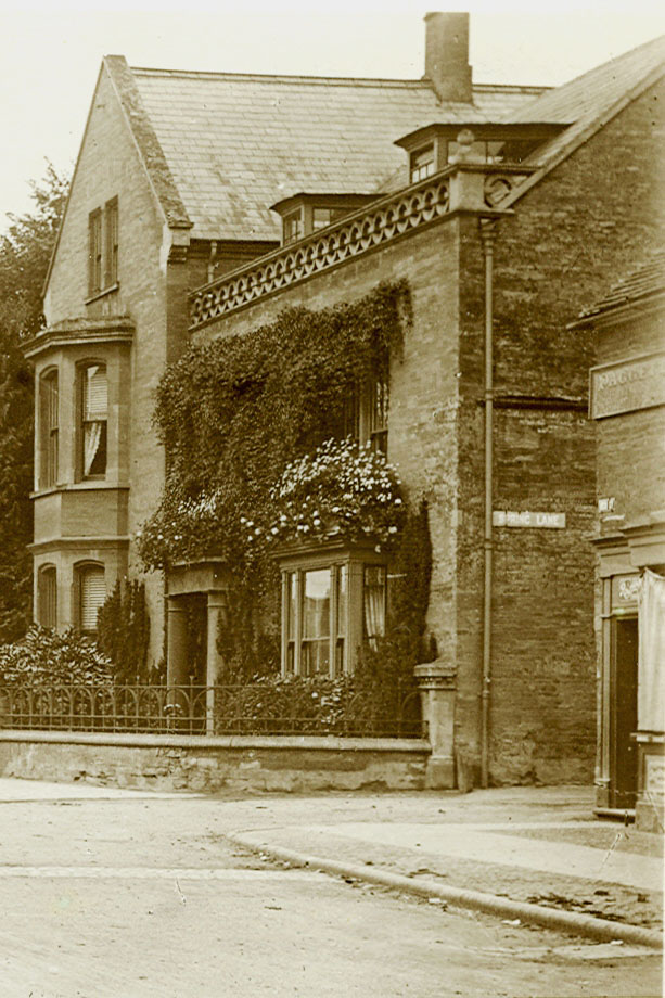
Spring Lane and Westlands (now the Cherry Tree Restaurant) c. 1910
Spring Lane was extremely narrow before Number 3 High Street, its doorway just visible on the right of the 1910 photo, was demolished when Spring Lane was widened in the 1950s. It was just about wide enough to accommodate the passage of one horse and cart!
You will of course observe that Spring Lane is not exactly wide now, and you will remember that – as its name implies – this lane also had a significant stream flowing down it, before the stream entered the High Street. So how did this road junction develop over the centuries to arrive at the status shown in the 1910 image? Now there’s a thought to ponder on!
We are back where we started at the Cherry Tree restaurant and at the end of this trail.
.
.
.
Further information on the Points of Interest in this trail, and on many other aspects of Olney’s history, can be found on Olney & District Historical Society’s extensive website.
On behalf of the Olney & District Historical Society and the Cowper and Newton Museum, we trust that you have enjoyed this trail around Olney High Street.
If you have walked this trail using the directions presented on your smartphone, you may just have noticed that this trail has conveniently ended within a few metres of a dozen or so restaurants and coffee shops situated around the Market Place. So before leaving for home, why not make your selection and enjoy?!
If you have not had an opportunity to visit the Cowper and Newton Museum on this occasion, then please consider a visit to this amazing heritage attraction in Olney in the near future.
![]()
.
The ODHS is indebted to Amy Botes for offering to provide and completing the full set of voiceovers for this Olney High Street – Heritage Trail (Smartphone/Audio Version).
.
September 2020
(Amended September 2022)
Copyright © 2020 Olney & District Historical Society
.