|
The Ford
|
|
 |
 |
|
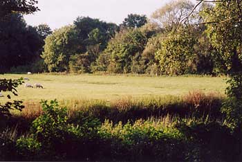
In the middle of the picture (above left) you can just about see the line of the original un-metalled road which ran from the Buckingham Road to the ford. The ford dates from a time before the embankments and bridges were built.
Where the grazing land is in the picture, it is thought there were ponds (although this has not been proved) which provided water for the mill. Therefore the original purpose of the sluice gate would have been to regulate the height of the river to ensure there was enough water to operate the wheel. |
|
 |
|
 Diagrams by J. Marchant |
|
|
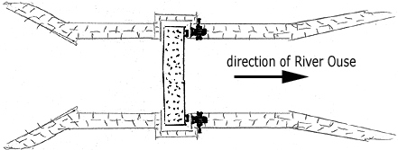
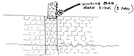
It is thought there was a sluice gate up-stream of the ford (where the dam now is) that could have been closed to lower the height of the river. There was a second sluice gate (no.15 on 1881 map) which would have been opened at the same time to let the river level drop. This would allow the river to be forded by traffic. Because the route was on a natural flood plain, eventually, the ford and sluices were scrapped (the last one in 1943) in favour of a tarmac road on an embankment with three bridges.
|
|