|
The turbine house (no 6) and leat (no 5)
|
|
|
The hyro electric-system was installed in the early 1900's and generated enough power to light the house.
|
|
On the map (left):
No.3 is a sluice No. 4 is an overspill chute that had a gate in it. The purpose of this was to stop the leat overflowing in times of high water. The water would be diverted straight into the river (now demolished). No.5 is the leat. It starts under no. 3 and goes under the lawn where you can see a slight dip. It ran along the north west side of the house. The new swimming pool (built c.1930) was built to the edge of the leat wall. The purpose of the leat was to run water down to the undershot water-wheel by the turbine house, which generated electricity for the house from c.1905 - c.1930s. There were a lot of problems with controlling the flow of water to have a constant speed to generate the correct voltage. This in turn caused bulbs and fuses to go. No.6 is the turbine house |
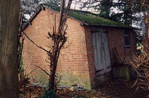
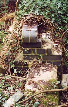
1992 This is the turbine house (no.6) built of local fletton brick with an asbestos corrugated roof. All the site is now being over-grown by trees. (no. 6 on map) |
 1992 Notice the bridge, this linked the overflow system from the wheel to the river. |
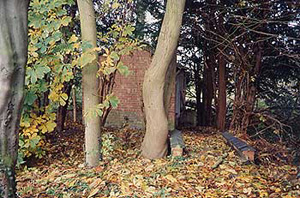
 2002. Most of the turbine house has fallen down. |
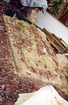
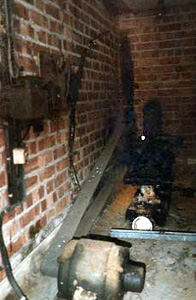
The turbine bed on which the turbine stood. |
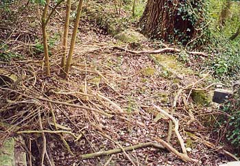 This shows the leat joining the mill race lined with blue engineering bricks. The leat would have been about 10 ft deep. In the foreground is where the undershot water wheel would have been. |
 2002: blue engineering bricks |
 |
Picture left: This is where the mill race empied out into the river. The galvanised pipe was a later addition to pump water from the river up to the reservoir. River water was used to irrigate the gardens and flush the workmen's toilets. This was put in after the hyrdo electric scheme had given way to mains power.
|
|
Picture above (Nov 1992): This is where the water came out of the mill race. The brick walls made from blue engineering bricks are 1ft 6in wide each side. The width between is 7ft 9in. The galvanised piping running up is a later addition for pumping water out of the river. It is a great pity that the whole of this site is being filled in. |
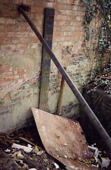 The heights marked on the board refer to feet above sea level (rather than the river level) |
|
Picture above (Apr 2002): the concrete leat wall running up to blue engineering bricks on which the 10 ft undershot water wheel was set. |
Picture above (Apr 2002): the concrete walls of the leat. The inside width is about 8ft 4in. The depth ran down from 2in to about 10ft. Picture below: The end wall of the turbine house facing the river where the water came out of the undershot water-wheel. The wooden measuring board has metal numbers on showing the number of feet above sea-level. The top number is 233ft. The galvanised pipe is part of the section of pipe that was used to pump water up from the river. |
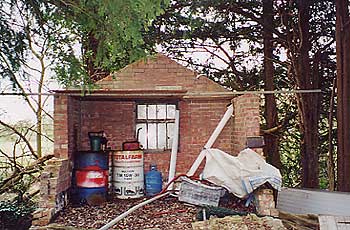
 The turbine house was converted c.1939 into a pump house in which to house an electric motor which pumped water from the river up to the reservoir. |
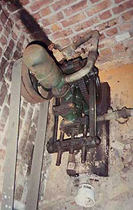 The belt driven pump unit, fitted by Flemmings of Stony Stratford. The two units are now at Milton Keynes Museum. |
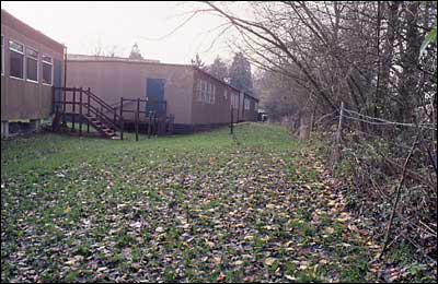 Prefrabricated buildings used as classrooms, built up to the leat circa 1980's |
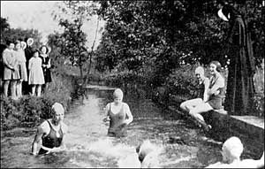 c.1920 Girls swimming in the leat (no. 5 on map), chaparoned by the nuns. Notice the old type habits. The purpose of the leat was to run water down from the dam to the turbine. |