|
|
Adapted from The History & Antiquities of Northamptonshire 1791 by John Bridges and The History & Antiquities of the County of Northampton by George Baker 1822-4
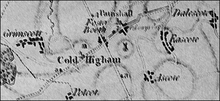
Brief History of Cold Higham Baker follows Bridges in suggesting that Cold Higham derived its name from "its exposed and elevated position". The village was formerly known as Hecham, Hecham Parva and Little Higham. The statistical boundary lines between Cold Higham and Grimscote are difficult to draw, since Grimscote always appears to have been the larger settlement, yet the ecclesiastical parish is that of Cold Higham, and both have latterly fallen within the wider area of Greens Norton. The situation is probably best described by Baker: "The largest extent of this lordship is computed at a mile and a half. It contains about five and forty houses, including thirty two in the liberty of Grimescote, which is at present supposed to be a member of Cold Higham; tho' anciently they were names indifferently used for each other, and the township of Cold-Higham now lies within the Manor of Grimescote. Eight of these houses, which stand in all Grimescote, are set apart for the poor."
As the two have so often been considered as one, statistical data such as census figures cannot be disaggregated. The composite picture however is an interesting one, showing the familiar rise in population in the early part of the 19th century, followed by a decline which became permanent. In the absence of permitted development in the latter part of the last century and the trend towards smaller families, the population is down to half what it was at its peak in 1841, though the number of houses remained fairly constant at around 70 for most of the 20th century.
At the time of the Domesday Survey in 1086, Cold Higham was held by the Earl of Moreton, and its history is bound up with that of the manor of Grimscote, which then passed to the Whilton lords. The estate must have been sub-infeuded, for by 1315 there were four lords of Higham, Potcote and Grimscote - Robert de Daventre, John de Grimescote, Richard Foxele and John de Patishull. In the early 15th century the Daventre family conveyed their portion - along with the advowson of the church of Cold Higham - to William de la Pole. This transaction subsequently became the subject of legal argument, with the de Daventres being accused of fraudulently witholding some of the lands the de la Poles thought they were due. The de la Poles succeeded in their case, though the lands and manors again became the subject of legal manoeuvring with the next owners, the Langleys. (Read about the Langley Cartulary). The lands and titles were subsequently acquired by Sir Richard Empson, and then sold to the Earl of Pomfret, with whom they remained. However, by the time of the 5th earl, the estate was no longer considered to be manorial, and the only recognised lord of the manor at the time of inclosure in 1812 was the Duke of Grafton.
By 1824, Baker reports that the principal proprietors in Cold Higham were the Duke of Grafton and the Earl of Pomfret, and that a third of the parish was in permanent pasture.
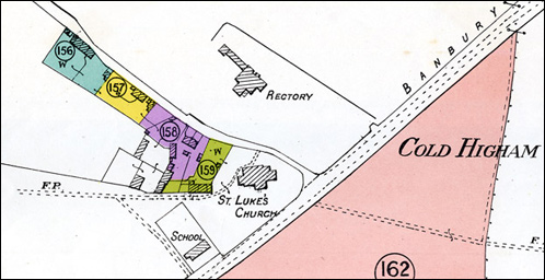
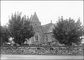
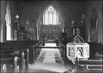
For the rest of the century Cold Higham continued as it had been for centuries before - an agricultural community. It acquired a school in the 19th century, and this - like the church - served surrounding villages, even larger ones like Grimscote. Stanley Dickens, in his autobiography "The Life & Experiences of a Farmer's Fourth Son", part of which has been transcribed (click here to read it) was baptised at the church and attended the school in the 1890s. His account paints a vivid picture of rural life in the area at the time. Cold Higham church is dedicated to St Luke and is described by Baker in 1824 as "a small and gloomy edifice". At that date it consisted of a saddle-back tower containing four bells and dating from the 13th century. He described the interior as "neatly pewed" with a gallery having been recently erected across the west end. At the time, the north side of the chancel belonged to the lay improprietor and the south side to the Rector. He describes the churchyard as "nearly circular, and thrown up higher than the surrounding ground." At the time it was planted with "lofty elms, visible as far as Bow Brickhill in Buckinghamshire to the south and Naseby to the north." He also mentions the shaft of an ancient cross still remaining on the south side of the churchyard.
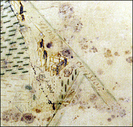
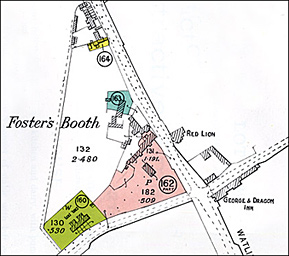
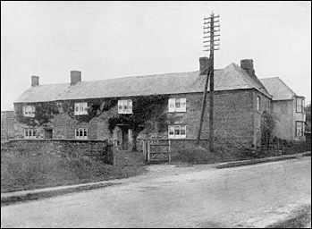
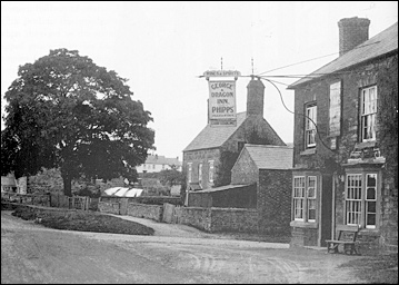
Within the parish of Cold Higham can also be found that part of Foster's Booth situated on the west side of Watling Street. Foster's Booth (previously called Forster's Booth) is a small hamlet formerly lying partly in Cold Higham and partly in Pattishall, and now counted entirely to the latter. It began life - so Bridges describes it - as "the hut or booth of one Forster, a poor countryman", who seems to have decided to make a living out of providing refreshment to travellers on Watling Street. No date for this is given, but a number of houses are shown on the Survey Map of 1727 (see below). Note that the map would not have shown area the Duke did not own, so nothing appears on the east side of Watling Street. By 1791, others had copied Forster's example and according to Bridges the one booth "grew little by little to a fair street of inns. The houses are built each side the Watling Street, which passeth thro' the middle of it. The Earl of Pontefract keeps here his hundred-court". The Cold Higham rentals of 1740-50 list two people leasing an inn each at Foster's Booth, and the tenancies and changes can be tracked through the Estate Rentals up to 1875, though only The Crown seems to have survived as an inn. No mention of it appears in the Estate Sale of 1919. The longer-lived premises at Foster's Booth shown below on the sale map for Cold Higham were neither of them owned by the Duke.
|
|||||||||||||||||||||


|