The manor of Bradwell was owned by the Fuller family throughout the 1600s, but, in the early 1700s, when there was no longer a male heir, the estate came into the hands of Thomas Mercer, who had married one of the Fuller daughters. In 1787 the Mercers sold the property to William Bailey, who followed a common practice of the time and enclosed land, in this instance 855 acres. The process of enclosure had occurred since the 12th century with 325 acres being enclosed in Bradwell in 1501 and 1506-07. The practice was echoed elsewhere, with land enclosed in Snelshall in Tattenhoe before 1517 and Loughton in 1584 (Reed; Turner, 45). The medieval system of open fields, common lands and communal farming practices was replaced by crop rotation and controlled grazing. While there was enhanced soil fertility and agricultural productivity while numerous plants and animals benefitted from the increase in hedgerows, the transformation disrupted the lives of those people who had farmed. They lost their right to farm allocated strips of land in the open fields, graze their animals on common land and to gather wood from uncultivated land. In some areas there was the destruction of property, threats of violence against individual and rioting. In Buckinghamshire there was only one case of fence breaking and wilful damage of the new enclosures (Turner 174). William Bailey soon sold some of his land to William Hooton and the two men dominated landownership in the area. They were based in Home Farm, Primrose Lane. This a late medieval or sixteenth-century house with its diaper patterned tiled roof was enlarged in the seventeenth century and is probably the oldest secular building in Bradwell. The other major building had its origins in the medieval period but was reconstructed and enlarged — there is a 1790 — Manor Farm, near St Lawrence Church. Other reminders of the period are the sixteenth century Brookfield Cottages, formerly Brookfield Farmhouse, named after the Brookfield at the time of the enclosure, and Moat House. A stone above the door reads TM [for Thomas Mercer] 1784 but the site was probably a building before that date.
Bradwell House, a detached house at the edge of the village, was developed from a 17th century farmhouse into s rather grander residence when a south frontage added in the early eighteenth century. It has two storeys and is built of red brick with a hipped tile and slate roof behind a panelled parapet. The 18th century south front originated with five bays with brick pilasters and segment-headed windows. Two more matching bays were added in matching materials to the east in the 19th century (Pevsner). At a similar time the front door was relocated to the western side, off Loughton Road, enclosed by a substantial porch in yellow brick. The previous entrance was on the south elevation, which was replaced by the central window of the 18th century facade. According to a report made in 2020 the house is marked on Jeffreys map (1768) and on the OSD (1815). The building was extended to the east in the mid-19th century (English Heritage listing). It was purchased by William Baily in 1787 (Cows Before Concrete) and passed to his son, Joseph, on his death in 1802 (church window in Bradwell). By 1815 (OSD) the garden contained a short avenue focussed on the south entrance doorway and two ornamental ponds. Joseph died in 1817 (Gentleman’s Magazine) and his widow, Celia, continued to live in the property. By 1825 the house had a short avenue of trees to the south (Bryant). During this period the property was owned by Joseph and Celia’s son, William James Baily, (1839 tithe map and schedule). There is a copy of the map on the Bradwell Bury page. It shows that the garden layout remained similar to 1815. Celia Baily died in 1859 (church window in Bradwell church). William George Duncan JP purchased the property in the mid-1850s and died in 1876 (church window in Bradwell church). For the next half century, Bradwell House was owned by a Mrs Jones and was occupied by a number of different tenants (Kelly’s Directories).
Turnpikes
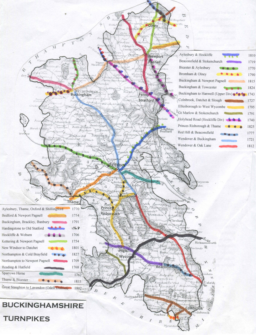
Source: http://www.turnpikes.org.uk/
In the early 1500s there was a medieval ridge-and-furrow field system around Bradwell but links to those outside the parish were poor. To maintain the roads an act of 1555 (and not abolished until 1835) imposed an obligation on parishioners to do four, later six, consecutive days’ unpaid repair work every year. The first Turnpike Act was passed by Parliament in 1663. This allowed tolls to be collected on maintained stretches of road. Between 1695 and 1706 Parliament empowered the men held responsible for maintaining the roads, the Justices of the Peace to establish trusts to further turnpike roads. This was widened to include local men of substance. In 1706 the Hockliffe and Woburn Turnpike Trust was established. It administered the London-Chester road between Fornhill and Stony Stratford.One of England’s first turnpike roads was built on Watling Street between Two Mile Ash and Hockliffe, Bedfordshire. A toll gate was built on Watling Street in the south-western extreme of Bradwell Abbey land in 1740. In 1755 the trustees authorised their surveyor ‘to pick or gather stone in Bradwell fields for the repair or mending of the turnpike road’. In 1771 gravel was added. Nevertheless in 1794 surveyors James William and Jacob Malcolm described the Fenny Stratford to Stony Stratford road as ‘miserable indeed’. Trusts built, maintained and administered around 30,000 miles of road with about 8,000 toll-gates. They were an important feature of the landscape and one of the central pillars which supported industrialisation.
Canal
The route of the Grand Junction Canal (constructed in the late eighteenth and early nineteenth centuries) passed through the north of the parish crossed the Bradwell Brook valley on a large embankment, through which ran two brick culverts carrying the brook. Soon afterwards a wharf and the ‘New Inn’ was built where the road running north from the village crossed the canal. In 1992, to carry the canal over Grafton Street, a concrete aqueduct replaced the older earthwork.
Windmill
An early example of powered production was the windmill, an idea said to have been brought to England by the Crusaders. While upper reaches of Bradwell Brook were unsuitable for a watermill there was (according to a will dated 1558) a windmill to the south-east of the village. There is further evidence in place names Windmill Furlong in 1648, a Windmill Field in the mid-1600s and a field called Windmill Ridgeway in 1839.
Bradwell Windmill
The present stone tower mill in the north of the parish was built to mill corn in about 1803 by Samuel Holman for over £500. Along with gravel, limestone and lime from the nearby quarries and kilns, flour could be despatched by narrowboat. As transportation became easier, the price of coal fell and it replaced wood as the principal domestic fuel in the Bradwell.
Samuel died in 1825 and his wife and son took over. It was subsequently owned by Elizabeth Curtis and passed into the ownership of that family. One miller, William Carr carved his name into the tentering beam. In 1857 Robert Adams brought the mill and his son also Robert, added a steam engine for days when it wasn’t breezy.
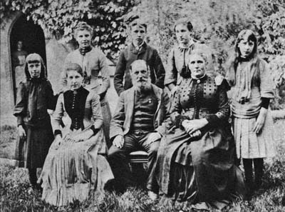
Robert Adams Junior and Family
Grain was imported from north America and milled in steam powered, rolling mills and then distributed by rail. There was a reduction of arable farming in north Buckinghamshire and the windmill ceased operation in 1876. The mill closed in the 1890s and in 1991-92, to carry the canal over Grafton Street, a concrete aqueduct replaced the older earthwork. Its working life lasted for less than eighty years.
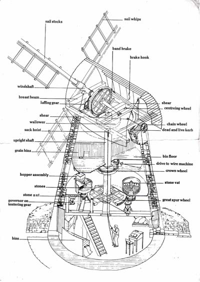
Ownership passed to Milton Keynes Development Corporation and then in the 1990s to Milton Keynes Council in 1997. It is managed by the local museum. The Friends of Bradwell Windmill group was established and the mill had its first open day on the May bank holiday 1996. Extensive work has been done and it is now opened on occasion for public visits.
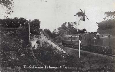
The railway line is now pedestrianised and called the Railway Walk.