A late Saxon or early medieval village developed in Bradwell, the name was probably derived from the Old English (the language of the Saxons) ‘broad spring’. There may have been a central green with the older buildings and earthwork sites disposed around it and the roads (now Abbey, Primrose, Loughton and Vicarage) forming roughly circular boundaries. Pottery of middle to late Saxon date was found during the excavation of the sixth to seventh-century moated manorial site, Bradwell Bury, (now Bradwell sports grounds) There were timber buildings there by the ninth or tenth century and a stone house in the thirteenth century. The medieval moat around the Moat House dates from the time of Bradwell Bury. It is the remains of a far larger moated area. Evidence has been found of burials in the surrounding (probably largely wooded) area. The post-Roman turf meeting place mound of the Secklow Hundred (at the rear of the City Centre Library) was used from Saxon times through to the thirteenth century and is situated at the junction of Bradwell, Great Linford and Little Woolstone parishes.
The Normans’ Domesday Book of 1086 recorded that the existence of a village Bradewelle. Alviet, or Alward, a man of Queen Edith, c1025 –held 1½ hides, the ‘hide’ being the amount of land workable by one plough in a year which could support one free peasant household. The exact number size varied but it was often said to be equal to 120 acres. Soon Walter Giffard took possession of Bradwell, though there were other claimants to it. A charter dated c1151–4 named William de Bayeux as lord of part of this estate and Bradwell seems to have been in the family until at least 1348 when an order was issued for the arrest and imprisonment of William of Bradwell. Other land in Bradwell was held by the lords of Stantonbury, the Barry family.
The parish of Bradwell’s northern boundary was the Ouse and the western, Bradwell (or Loughton) Brook. The southern border with Loughton parish was medieval furlong boundaries, except for one section where it dog-legged along the ends of individual strips. There were lighter well-drained soils in the valley at the north end and heavy clayland in the south of the parish. The medieval village was at the intersection of an east-west route which linked Wolverton, Bradwell Abbey, Bradwell village and the Woolstones, passing the Secklow meeting mound. The north-south route connected Oxford and Cambridge via Buckingham, Bedford, Stony Stratford, Newport Pagnell Loughton and the Shenleys.
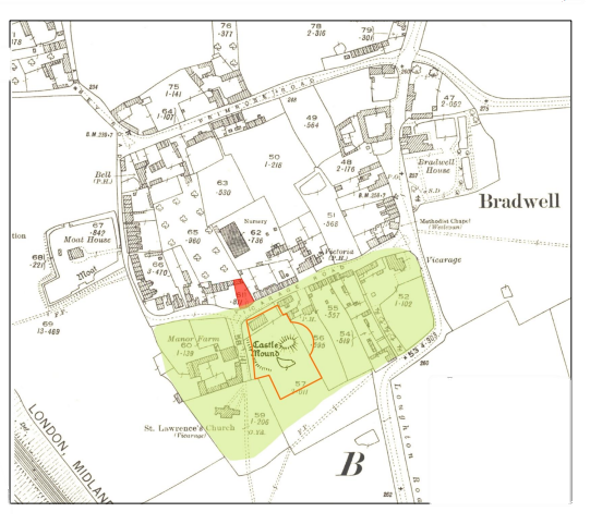
There was a debilitating civil war during the reign of Stephen, 1135-54. Many motte-and-bailey castles were constructed during the period, including ones at Shenley Church End and Wolverton. Recognising the strategic importance of the area (Watling Street and the east-west road from Bedford to Oxford were important routes) the baronial family which held one of the manors of Bradwell, de Bayeux, ordered the construction, in Bradwell, of a motte, a large conical mound of earth or rubble topped by a timber tower and a small bailey (a fortified courtyard with a ditch or palisade).The remains of the castle are in the field to the north-east of the church and south of the village hall. The site would have been larger with parts of the Prince Albert car park and the Memorial Hall now covering it. The deviation in the line of Loughton Road as it enters the village might be because it followed the earthworks of the outer bailey. A 2022 archaeological report located a substantial medieval ditch, most probably part of the bailey defensive works of Bradwell Castle. Contemporaneous with the castle the Moat House manor site was created. This site, together with the motte and bailey and Bradwell Priory indicates that this was an area intensively settled in the medieval period. Although it was probably occupied until the 14th century the only archaeological evidence regarding the dating of Bradwell’s castle are pottery sherds from 12th or 13th centuries graves. Depressions in the surface of the motte are said to be the results of attempts by the Reverend Conway Davies and villagers to construct an air raid shelter during World War II. It is now a scheduled ancient monument.
Conjectured original extent of the motte & bailey based on field surveys,landscape analysis and LiDAR. The postulated original extent of the motte & bailey is in green, the scheduled area is marked with a red line and the other marked site is now 28a Vicarage Road
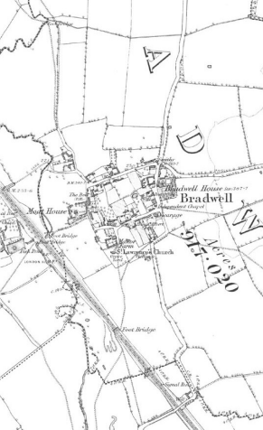
The earliest extant part of the Church of St Lawrence the nave and the south aisle, date from 1190-1210, that is after the civil war. A vicar was appointed in 1223 and the south aisle rebuilt and then a tower added in the late 13th and late 14th centuries. The right to nominate an incumbent was granted by William de Bayeux and Robert de Bradwell to Tickford Priory, Newport Pagnell (founded 1140) rather with the Priory of St Mary, Bradwell Abbey, which was only built in about 1154. Two bells date from c1297, while a bell dating from c1490 was repaired in 1907 and then in 1970, was retired to hang inside the church. After the dissolution of Tickford Priory in 1525 Bradwell church became the property of the King. He granted it the Tickford estate to Cardinal Wolsey who used the income endow a college at Oxford. After Wolsey fell from favour the church was returned to the king, who arranged that when a Benedictine Priory at Snelshall was dissolved in 1534 that four bells and other materials would go to St Lawrence. When Bradwell Priory was suppressed material were salvaged to build the north porch, to heighten the nave, add windows and rebuild the tower.
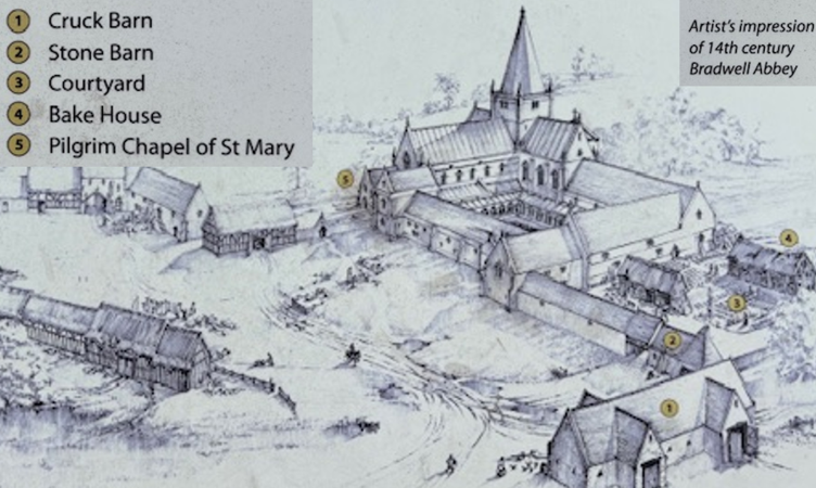
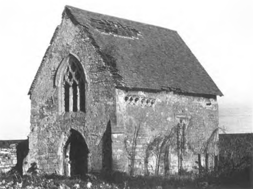
In about 1154-55 Meinfelin (baron of Wolverton and the Sheriff of Bedfordshire and Buckinghamshire since 1125) gave land across the brook to Benedictine monks from Luffield Priory (a site now close to Silverstone racetrack) to establish Bradwell Priory. Although the area, now home to an industrial estate, is known as Bradwell Abbey, this is a little misleading as the Benedictine monks’ priory, was never part of an Abbey. The monks at Bradwell survived on donations, rents from land gifted to the priory and had their own fishpond and a watermill in Wolverton. The priory expanded in the thirteenth century and the ‘Cruck Barn’ was built in the early fourteenth century. In mid fourteenth century many buildings fell into disrepair when the priory was badly affected by the plague. Nevertheless, in 1431 the monks opened a school on the premises and around 1330-50 a healing shrine, the Chapel of St Mary (with notable wall paintings was constructed. Many pilgrimages visited. In 1506 the priory enclosed 300 acres of previously open land but in 1524 the priory was suppressed and granted to Cardinal Wolsey. The cleric leased the land to William Wogan who built a farmhouse using the stones from the disused priory while Wolsey spent the income on the endowment of his new college at Oxford. The property reverted to the Crown on Wolsey’s death and was gifted to Arthur Longevill, Lord of Wolverton.
The chapel in 1960. Photo: C N Gowing
Source: Discovery Centre information board