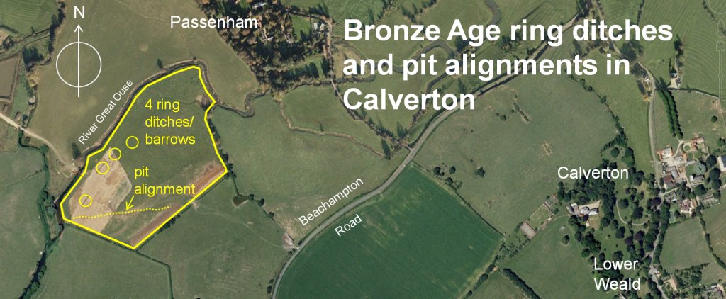
Passenham Quarry, Calverton
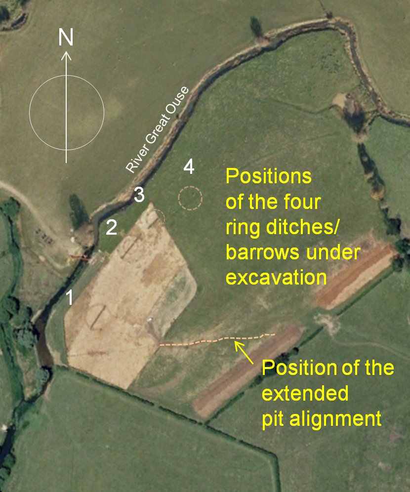
This Bronze Age archaeological site lies on the very edge of the western border of the parish some 900m from Calverton and Lower Weald. When investigated by Northamptonshire Archaeology in 2006/7 prior to gravel extraction, it was found to contain a group of four ring ditches, presumed to be levelled Bronze Age round barrows which formed a linear cemetery on low-lying ground adjacent to the River Great Ouse. The excavations also revealed an alignment of some 90 late Bronze/early Iron Age pits running East -West across the southern part of the site.
Description of ring ditches/barrows
The original form of these monuments would typically have had a raised central barrow mound created from spoil excavated from the surrounding ditch to contain a burial. However, only one ring showed a slight doming of the inner area to confirm this. All the others had been ploughed flat in the past and the absence of any deeper burial remains led the archaeologists to assume they may only have contained shallow cremations typical of an early second millennium date (2000-1400 BC).
Being so close to the river, the ring ditches would have gradually filled with debris and alluvium during floods. When excavated, the ditches were found to have originally been around 1m deep, but no contemporary internal features had survived. There was little other material evidence to date the barrows, but the upper ditch fills did contain residual Iron Age pottery from nearby settlement.
The pit alignment – Late Bronze Age to mid Iron Age
Just to the south of the circular barrows, a previously unknown series of pits was discovered strung out in a line running roughly at right angles to the river. These too had been filled with debris and flood silt over time. This feature is known as a pit alignment and is believed to had had some sort of boundary marker function during the late Bronze Age to middle Iron Age.
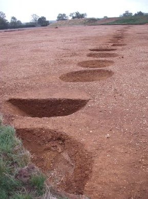
A total of 92 pits were excavated by the archaeologists, all generally circular or oval in plan, and around a metre in diameter. Pit depths varied between 50cm to just over 1 metre and they were spaced some 2.5m apart. The upper fills of most of the pits contained residual early Iron Age pottery, with some 1000 sherds being recovered. At the time this suggested that there was likely to be an associated domestic settlement nearby, which may have been a precursor to known middle-late Iron Age and Roman settlement that was also located by geophysical survey and confirmed by subsequent excavation to the immediate east of the investigated area.
Ring ditch/barrows and Pit Alignment text from a report by Ed Taylor, and text covering the later investigation of the extended alignment by Charlotte Walker – both of Northamptonshire Archaeology.