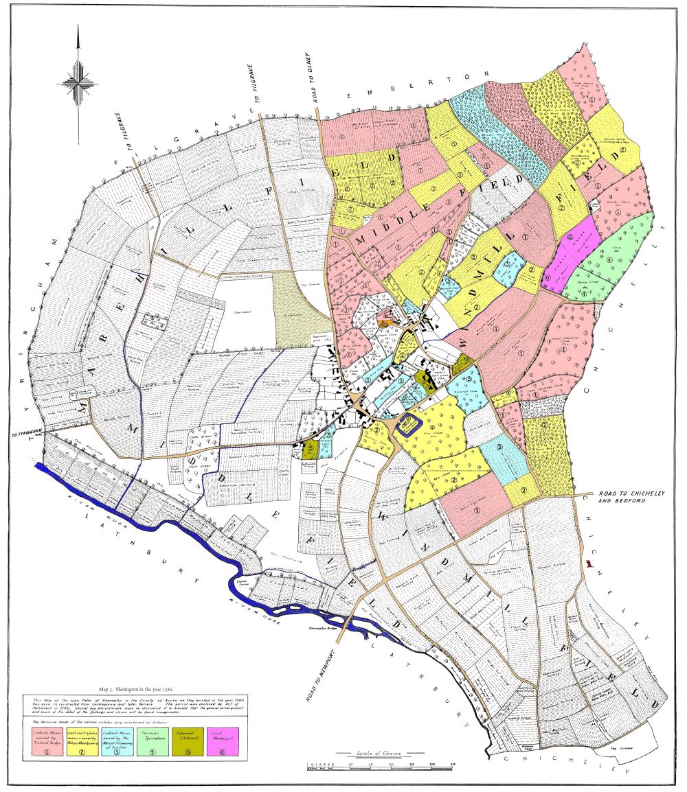
This map shows how Sherington might have looked c.1580. It is not an actual old map, but a reconstruction by Professor Chibnall originally published as Map 3 in his book “Sherington: Fiefs and Fields of a Buckinghamshire Village”.
The process he used to construct the map, together with his assumptions and justification, is described in Appendix 1 of the book. The starting point was the 1796 enclosure map and he worked back in time, piecing together the known historical data, rather like a jigsaw puzzle.
The original black and white map was drawn by Mr E W Tole. It has been digitally enhanced to remove blemishes on the paper copy and colour has been added to improve clarity.

The demesne area was located in the north east. The colours (which follow Chibnall’s numbers) indicate the division between the principal landowners at that time.
The distribution of land is given in the tables Open Fields and Demesne (links on the right). This information is taken from Tables 49/50/51 and 47/48 of Chibnall’s book, respectively. Note that there are a number of detailed discrepancies between the information on the map and that given in the tables.
Links to the other maps listed below can be found on the right.
Larger scale maps of the four quadrants: North West, North East, South West, South East.
In 1580, farming followed a 3-year cycle. The arable land was therefore divided into three fields: Marehill Field, Middle Field and Windmill Field. The division is shown on the Field map.
