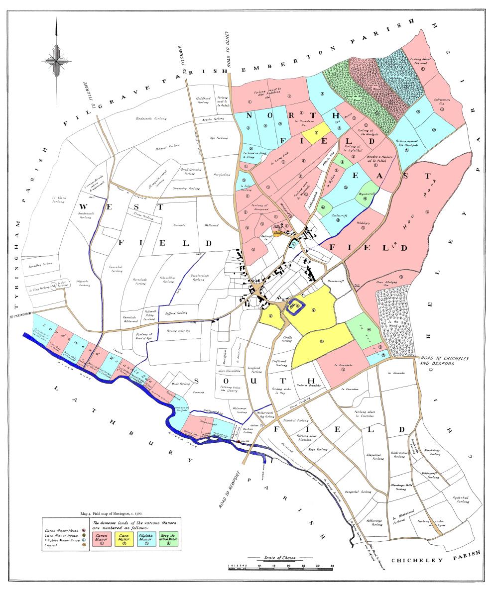
This map shows how Sherington might have looked c.1300. It is not an actual old map, but a reconstruction by Professor Chibnall originally published as Map 4 in his book “Sherington: Fiefs and Fields of a Buckinghamshire Village”.
The process he used to construct the map, together with his assumptions and justification, is described in Appendix 1 of the book. The starting point was the 1796 enclosure map and he worked back in time, first to 1580 and then to 1300, piecing together the known historical data, rather like a jigsaw puzzle.
The original black and white map was drawn by Mr E W Tole. It has been digitally enhanced to remove blemishes on the paper copy and colour has been added to improve clarity.

The demesne area was located in the north east. The colours (which follow Chibnall’s numbers) indicate the division between the four manors at that time.
The river meadows in the south west were divided into two sections, known as Lordsmead and Townsmead, part of the latter being called Wolasale Dole. The colours here reflect the division of the meadows between the Carun and Cockfield manors which had taken place in 1189. The meadows were divided further into about 290 strips running at right angles to the river. These strips, called roods, were on average about a furlong long and 28 to 29 perches wide. There are references going back to 1443 which indicate that parts of the meadows were allocated annually by lot.
Links to the other maps listed below can be found on the right.
Larger scale maps of the four quadrants – North West, North East, South West, South East.
In 1300, farming followed a 2-year cycle. The demesne area was therefore divided into two fields: the North Field and the East Field. The open fields were divided into the West Field and the South Field, the boundary being the Town Ditch, i.e. Water Lane. The division is shown on the Field map
