The absence of house numbers in the village at the time of the 1911 Census has meant that it has not been possible to pinpoint where each family actually lived, except for a few in named buildings, as most addresses were simply recorded as ‘High Street’ or ‘Church End’.
The 1910 Land Valuation Survey is very interesting as it provides that missing link.
The survey was carried out by David Feasey of Sherington. For the purposes of this survey, Sherington was included with Chicheley in a single area. There are 270 entries. Numbers 1 to 60 and 255 to 262 relate to land in Chicheley, the rest being in Sherington. The first data is dated 28 March 1913, but it then took several months to complete the details for all entries. All plots of land were identified and numbered, and both the occupiers and the owners were recorded, together with the valuation assessment.
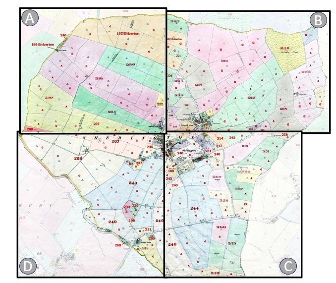
The Ordnance Survey maps that were current at the time (the 1900 1:2500 series) were marked up with the number of each plot of land and colour shaded to distinguish each plot and corresponding buildings.
Most of the parish is covered by four Ordnance Survey sheets – the corner where these sheets join being just north of The Knoll. They extend from the west to the east parish boundaries, and from the Emberton boundary down to beyond Sherington Bridge. The extreme south of the parish, i.e. Far End Farm, is on a separate sheet.
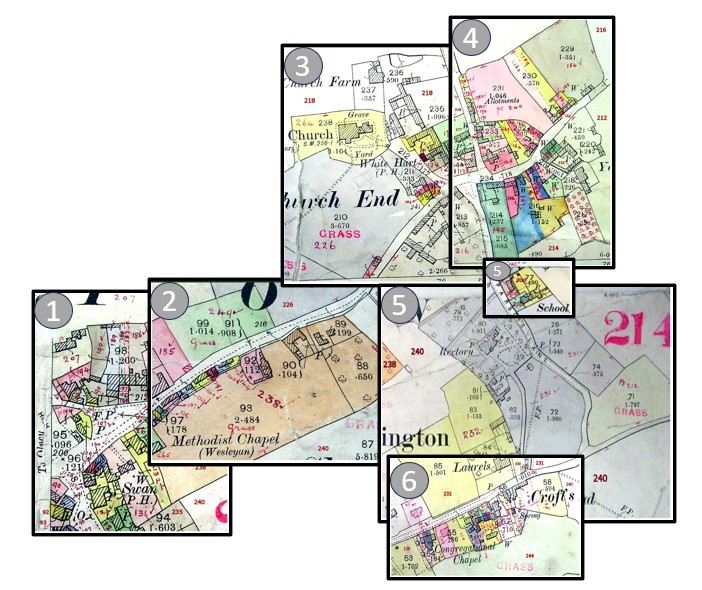
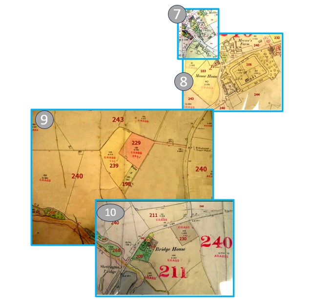
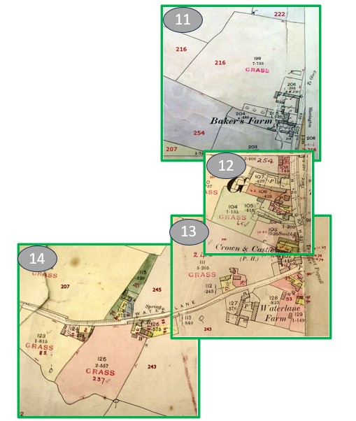
The Detail of the Properties is shown on 14 separate sheets (by road)
Each sheet has a Map and a Table of data – showing the tenants and the owners at each property
The Detail of the Fields is shown on 4 separate sheets
Each sheet has a Map and a Table of data – showing the tenants and the owners – and the crop type