
Place name evidence
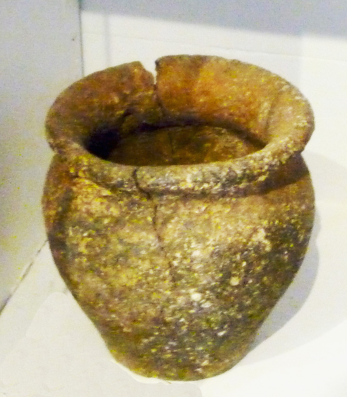
Late Saxon Pot – 10th century pottery found in River Ouse whilst dredging
Olney is first mentioned in a Charter of AD 979 as Ollanege (‘ege’ was pronounced ‘ey’, meaning Island), when King Ethelred granted ten hides of land there to Aelfhere, (and later in the Domesday Book it was known as Ollnei). Incidentally, a hide, from the Anglo-Saxon word meaning “family”, was, in the early medieval period, a land-holding that was considered sufficient to support a family. Although the ‘hide’ was a unit of land measurement in the broad sense, the amount of land that made up one hide would vary from one part of the country to another. In places where the soil was very rich, a hide of land would be smaller and where the soil was poor a hide would be larger. It was never a standard using fixed measurements. Consequently it could be assumed that at this time Ollanege was large enough to support ten peasant families. The name Ollanege is generally thought to mean ‘Olla’s Island’, Olla being a 10th century Saxon name. There is a further reference to the town in the early 11th century when in 1016 Olney was the venue for the Witan, a council summoned by Anglo-Saxon kings.
Before the Conquest, Olney belonged to Borgret, a descendant of the King of Mercia. Later, the Vikings came down from the north of England as far as the River Ouse which meant that Olney, being north of the river, came under Danelaw.
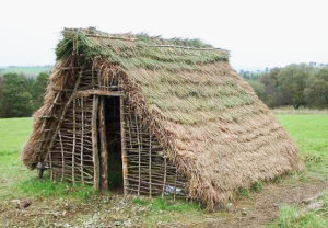
A reconstructed Anglo-Saxon Glubenhaus
Apart from the Olney Charter, the archaeological record has also managed to provide some evidence for the Saxon period in Olney. There have been several archaeological excavations which have yielded Saxon evidence, the most prominent and earliest is an excavation at the Cowper Tannery which revealed a series of post holes and chaff tempered pottery dating to the middle Saxon period. More tentative evidence for the middle Saxon period has been found at Rose Court, situated off the eastern side of the Market Place, where a sunken feature and hearth was interpreted as a potential sunken building or Grubenhaus. See image. Evidence for late Saxon period has also been found in excavations in ‘Lime Street’ and ‘Tunn’s Cottage’, close to the river bridge.
‘The Old Churchyard’ and Christian Wells
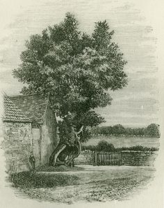
The Old Churchyard Elm
At the northern end of the town is the Knoll, a green triangle, where the High Street branches between the Wellingborough and Yardley Roads. To the north of the Knoll is a row of terraced houses called ‘Feoffee Cottages’ built on an area formally known locally as ‘The Old Churchyard’. This site is believed to be the original site of the parish church. An elm tree (see image) sited opposite the Queen Hotel was known as ‘The Old Churchyard Elm’, the decaying bottom three metres of the tree was still in evidence during the 1950s. Interestingly, a deed of the Castle Inn which faced on to the Knoll, refers to that area of land as ‘Old church Yard’. In 1881 human burials orientated east west with complete skeletons were discovered during work to the rear of the inn, while the subsequent laying of services has unearthed more skeletons. Later excavations on this site failed to find evidence of burials or any structural remains of a church. It has been suggested that the burials may be Romano-British and connected to the settlement at Ashfurlong.

Field names for the north end of Olney
In addition to the burial ground, this area of Olney is believed to have another early Christian association, as a spring known as the ‘Christian Well’, mentioned on the 19th century tithe map. Although there is no trace of a specific well called Christian Well, an adjacent field called Christian Wells Close (see map) possessed many open springs on its eastern side. Incidentally, a particularly large and relatively deep open spring close to the former railway embankment was nicknamed by generations of schoolchildren as ‘dead man’s bog’. The field is now a housing estate. Also, on the south-east side of Christian Wells Close there is a large fish pond fed by the springs which is now formally referred to as the Whirley Pits.
It is also noted that before the houses in Moores Hill were built, this hill in Yardley Road was known locally as ‘White Cross Hill’ because a large white cross was situated at its top. Tradition has it, that the land from this cross down to the Knoll belonged to the Church. Moreover the spring water supplying the horse trough on the ‘Old Churchyard’ site in Yardley Road was possibly from a stream running beside the church, so could this be another contender for the ‘Christian Well’?
The presence of the burials and the reference to Christian Wells is not in itself, of course, enough evidence to suggest that these wells are of Anglo Saxon date – the name may have originated in the medieval or post medieval periods.
However, a well is referred to in the Olney Charter, of AD 979, as the “holy” or “saint’s spring” (halgan welle). It has been conjectured from work on Olney’s charter bounds that this well is located 2 km west of Olney on the Olney/Weston Underwood parish boundary. The ‘boundary’ well was renowned for its purity in the 18th and 19th century and is referred to in Cowper’s poem, The Task.
Several local historians have commented in the past that the density of Christian symbolism in this area of the town might well suggest that there may have been a monastery, or even a castle, in earlier times situated within Christian Wells Close, but to date no hard evidence has come to light.
Domesday Book
The Domesday Book contains one reference to Olney, the manor was held by Burgred, pre Conquest, and by Geoffrey the Bishop of Coutances after 1066. The total hidage attributed to the parish comprised ten hides with land for ten ploughs, meadow for a further ten ploughs and woodland for 400 pigs. The entry for Olney also included reference to a mill worth 40 shillings, and 200 eels thought to have been located on the site of the current mill house next to the church, and an eel farm. The total recorded population for the parish included 24 villagers, five small holders and five slaves. Pre Domesday, the manor of Olney was valued at £12, although after the Conquest the value had dropped to £7. One Freeman, who held 1 ½ virgates of land, is recorded under Burgred. (A virgate of land was in the region one quarter to one sixth of a hide.)
Discussion – Town layout
Considering both the historical and archaeological evidence, the settlement model for Olney in the Saxon period seems ‘bi focal’ in form, with evidence of settlement at the southern end and possible activity at its northern end. The southern settlement was located adjacent to the river Ouse and probably evolved as a crossing or fording point of the river, as well as being the location of the church and the town’s mill. The extent of this settlement may have encompassed the triangular market area. Olney’s market is a triangular shape which perhaps indicates that the market was formed from the meeting of three roads, High Street, Weston Road and Silver End. From map analysis it appears the market place might have been somewhat larger, incorporating the area to the south of the market including Osborne Court and part of Silver Street to the west. Although Silver Street leads to East Street, this road might have formerly been a direct route through to the village of Clifton Reynes.
At the northern end of Olney, at the Knoll, there is much more tentative evidence for a settlement, the principal support for this theory being the discovery of burials in the 19th and 20th centuries which were interpreted as indicating the presence of an early church. However, more recent excavation failed to find any evidence of a building. To the south of Ashfurlong an excavation of a ditch yielded a quantity of early-middle Saxon hand made pottery sherds. This area is in close proximity to the former Roman settlement of Ashfurlong and there is a question whether there was some sort of settlement continuity from the Roman period and if so what particular form this took? Interestingly there is a lack of archaeological evidence for Saxon period in the centre of Olney, an area that coincides with the medieval planned town. Whether this perceived absence is genuine or that archaeological deposits for the Saxon period exist in these areas but have yet to be discovered.