
Click (most of) the images for an enlarged view.
Olney, a small market town, is situated at the extreme north of Buckinghamshire, and sits on the banks of the Great Ouse. Two miles to the north of the town is Three Shires Wood, which marks the point where the northern most part of Bucks meets Northamptonshire and Bedfordshire.

Field names for the north end of Olney
Evidence of life in the Olney area goes back to Roman times. A thriving Roman settlement was active to the north of the town in Ash Furlong, a piece of agricultural land to the north-east of Olney (see map).
Subsequent developments in the Olney area were sited at what is now the northern end of the town in the vicinity of Christian Wells (see map). The original church was probably located adjacent to Hoppers Hill, and some believe there was a monastery or castle nearby, though this has yet to be proven. An elm tree (see image) sited opposite the Queen Hotel was known as ‘The Church Elm’, the decaying bottom three metres of the tree was still in evidence during the 1950s.
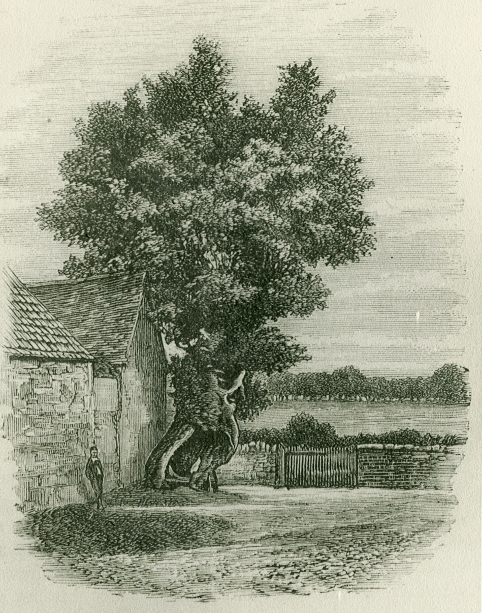
Sketch of the Church Elm
One of the first written references to Olney was in Saxon times, when it was mentioned in a Charter of 979 AD as Ollanege (‘ege’ was pronounced ‘ey’ meaning Island. Ollanege probably means ‘Ola’s Island’). Before the conquest, Olney belonged to Borgret, a descendant of the King of Mercia. Later, the Vikings came down from the north of England as far as the River Ouse which meant that Olney, being north of the river, came under Danelaw.
Following the Conquest in 1066, Olney, or Olnei, was mentioned in the Domesday Book and it was held by Geoffrey, Bishop of Coutances. He was a loyal supporter of King William I (the Conqueror) and was granted lands including Olney. When William died, Geoffrey supported William’s son Robert and lost his lands when William’s other son, William Rufus was crowned. These lands were subsequently given to the Earl of Chester.
By the 13th century Olney had grown from a large village to a planned borough, first mention of which is in 1237. The borough is distinctive, delineated by the High Street, with long burgage plots laid out at right angles and enveloped by the parallel back streets of East and West Street. The town possessed a weekly market and annual fair.

An earlier bridge over the Ouse
During the Civil War between the Royalists and Parliamentarians Olney achieved some minor fame at the Battle of Olney Bridge in 1643. Parliament held Newport Pagnell, and Olney was one of its outposts. Prince Rupert held Northampton for the King and marched on Olney intending to continue on to Newport. Prince Rupert and his troops took the Olney forces by surprise and the Parliamentarians retreated to the bridge where they made a defiant stand.
High St South & Market Place 19C
-looking north
The Royalists could have won decisively, had it not been for a rumour that Cromwell’s reinforcements were seen coming from Newport. The Royalists retreated and the battle was over.
Olney was on an early drove road. With travel increasing throughout the country in the eighteenth century Olney became a busy coaching town servicing the Kettering to Newport Pagnell Turnpike. In 1754 there were reputed to be twenty-seven inns in the town, catering for the coaching trade as well as for the locals.
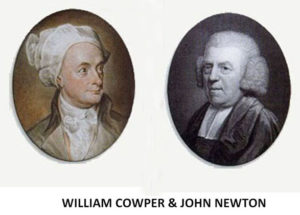
In the 18th century Olney became associated with its famous residents, the poet William Cowper who lived in Olney from 1767 to 1786, and John Newton the town’s curate from 1764 to 1780 who is accredited with writing the hymn ‘Amazing Grace’ arguably the most popular hymn ever written. During that time both men collaborated to write the ‘Olney Hymns’, and Cowper is acknowledged as producing some of his greatest work.
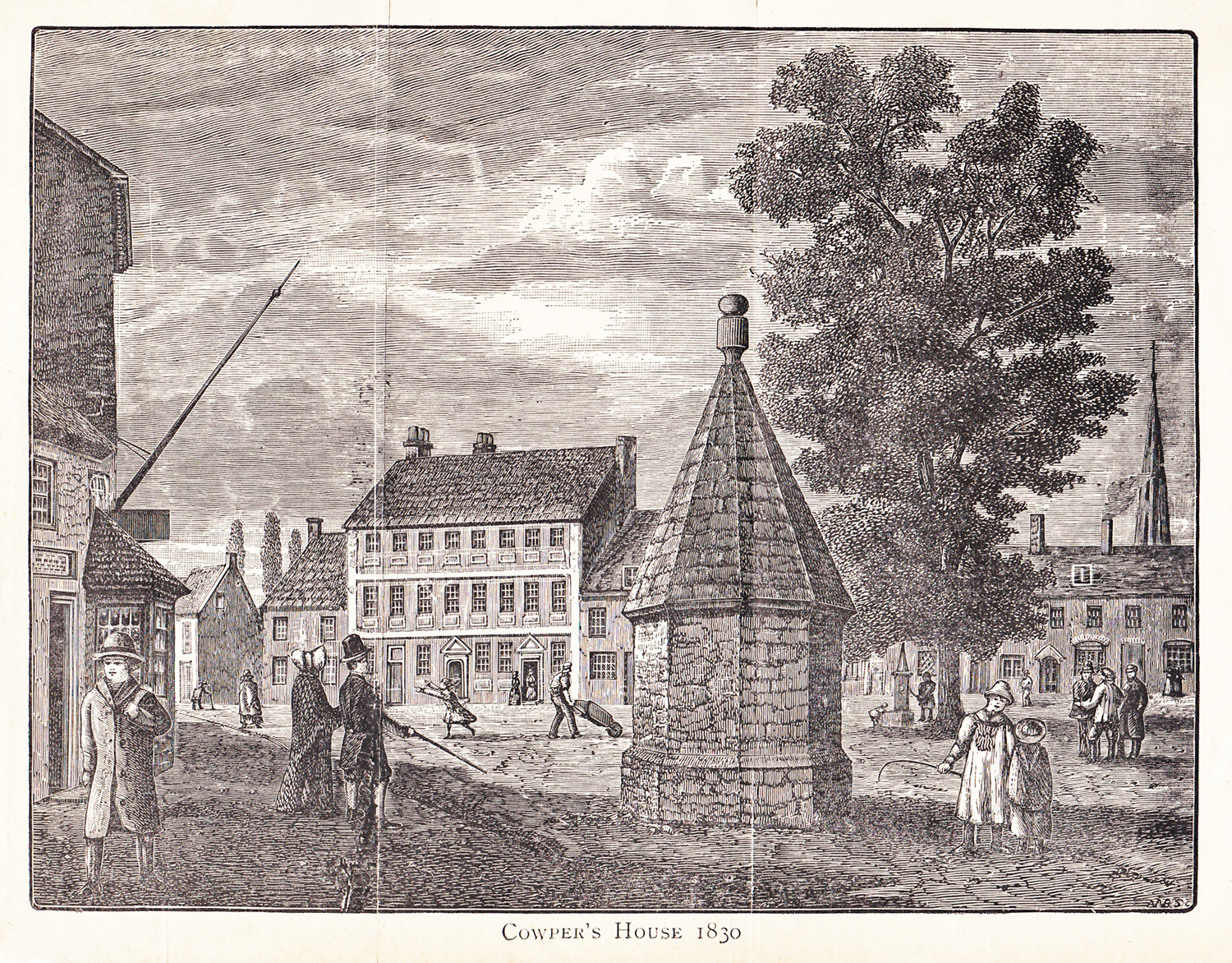
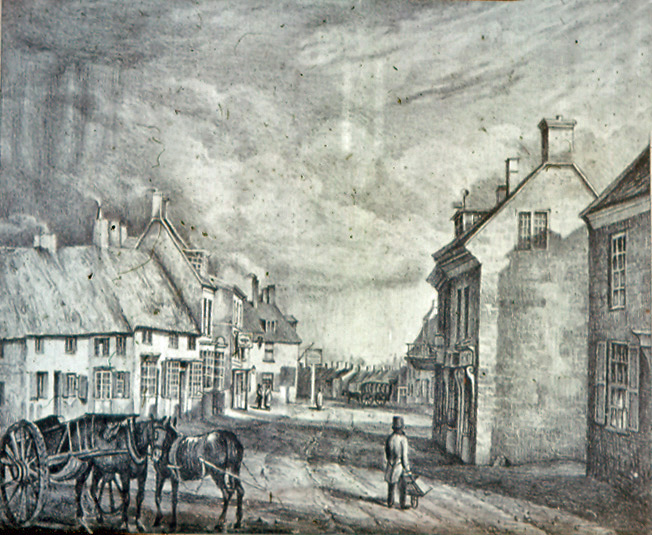
Illustration of the Market Place c.1830
taken from WC Lyons 1890 Almanac
During the 19th century Olney was always regarded as a relatively poor community and certainly not known for any prosperous enterprises. In particular during this century it was said to be poor and depressed; outbreaks of cholera and smallpox did little to improve this image. Nineteenth century census returns indicate that the townsfolk were mainly employed in the poorly paid farming, shoemaking and lace industries or in local retail and construction trades such as butchery, bakery, brewing, carpentry and building.
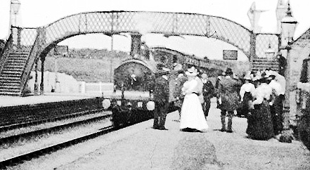
Olney Railway Station 1911
In 1872 the opening of the Northampton to Bedford railway line together with, a little later, much improved bus services, provided a means of transport for those seeking work in the slightly better paid industries and offices sited in the surrounding larger towns.
The industrialisation of the shoe industry during the second half of the nineteenth century resulted in factories being built in the town. The most notable were those of Hinde and Mann, Cowleys and Drages which arguably initiated the decline of the cottage shoe industry conducted in the workshops attached to many houses throughout the town. The shoe factories themselves declined during the first half of the twentieth century, particularly after WW1, but some smaller concerns did survive in Olney until the 1960’s.

Hinde & Mann Shoe Factory c.1900
Wellingborough Road, Olney
During the second half of the twentieth century, Olney developed substantially as a dormitory development for Milton Keynes. Extensive residential developments to the west of the town all but swamped the existing town which up until then comprised a long, wide, north-south high street, with two back streets (East Street and West Street) and a handful of side streets at its north and south ends. To the credit of local councillors, Olney refused to surrender its identity and today still retains the character and active local life of a small English country town. The High Street and Market Place have remained a focus for the town’s residents, for example: ‘The Olney Pancake Race’ held on Shrove Tuesday and ‘Dickens of a Christmas’ held in December.
Now, in the twenty-first century, the development of Olney is planned to continue as part of government policy for the South East of England. It is to be hoped that its friendly local feel will not be further eroded by disproportionate expansion.
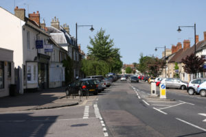
Recent image of Olney High Street
.Revised March 2019
Copyright © 2007 Olney & District Historical Society